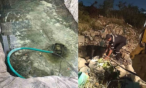

HYDERABAD: The Hyderabad Disaster Response and Assets Protection Agency (HYDRAA) removed 46 illegal borewells, seized 31 water tankers and dismantled 17 unauthorised storage tanks near lakes within the Core Urban Region Economy (CURE) limits between June and October as part of its crackdown on illegal groundwater extraction.
The enforcement drive covered four locations — Thammidikunta, Sunnam Cheruvu, Foxsagar and Tellapur village — with Sunnam Cheruvu accounting for the highest number of seizures. Officials removed 25 borewells and seized 21 tankers in the area.
At Thammidikunta, seven borewells were removed, four tankers seized and 10 storage tanks dismantled. Foxsagar accounted for seven borewells, three tankers and one storage tank, while at Tellapur, seven borewells were removed, three tankers seized and six storage tanks dismantled.
In several instances, operators drilled borewells on government land and connected them to storage ponds and tanker-filling points through underground pipelines.
HYDRAA Commissioner AV Ranganath said groundwater levels in Hyderabad had fallen drastically and that shifting commercial tanker operations away from densely populated areas within the Outer Ring Road (ORR) would ease pressure on domestic borewells.
He pointed out that household borewells were generally drilled to depths of 100 to 300 feet, while commercial operators were reportedly extracting water from depths of 1,000 to 1,500 feet. This had raised concerns among residents about domestic borewells running dry.
HYDRAA is coordinating with the Water Board, revenue, police, municipal and groundwater departments to intensify action against illegal commercial groundwater extraction, particularly in areas with high water demand.

HYDRAA TURNS TO SCIENCE TO TACKLE FLOODS
Hyderabad: HYDRAA plans scientific mapping across the Core Urban Region (CURE) to identify sites for rainwater harvesting, groundwater recharge and flood mitigation.
Commissioner AV Ranganath held discussions with experts from GSI, NGRI, Groundwater Department, IMD and TGDPS under Phase III of the Urban Flood Risk Management Programme.
The exercise will map geological formations, groundwater levels, recharge zones, flood-prone catchments and rainfall patterns from 2000 to 2025. Officials will also assess the need for additional weather stations and rain gauges to develop data-driven solutions to improve groundwater availability and reduce urban flooding.