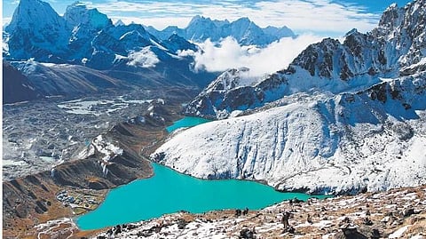

DEHRADUN: Wednesday’s devastating floods in Nepal have renewed concerns over hundreds of glacial lakes in Uttarakhand’s fragile high Himalayas, where accelerating ice melt is increasing the risk of glacial lake outburst floods (GLOFs).
Official assessments show that Uttarakhand has around 1,200 glacial lakes. Of these, 426 are larger than 1,000 square metres and together cover 3,347,671 square metres. Scientists warn that rising global temperatures are accelerating glacier melt, enlarging glacial lakes and increasing the risk of sudden and destructive flooding downstream.
The threat was starkly demonstrated by the 2013 Kedarnath disaster. Since then, the Centre and the state government have stepped up surveillance of glaciers and glacial lakes. However, scientists say continuous monitoring of the most vulnerable sites has yet to become operational on the ground despite budgetary approvals.
A detailed National Disaster Management Authority (NDMA) assessment released in 2024 identified 13 of Uttarakhand’s approximately 1,200 glacial lakes as vulnerable. Departmental sources classified five as Category A, four as Category B and four as Category C. The NDMA also called for periodic monitoring of the lakes.
The state subsequently appointed the Wadia Institute of Himalayan Geology in Dehradun as the nodal agency to scientifically assess five highly vulnerable lakes and install monitoring equipment.
Between 2024 and 2026, bathymetric and glaciological studies were completed at Vasundhara Tal in Chamoli and Mabang, Syuntiyangti and Pyungru lakes in Pithoragarh.
Bathymetric studies assess the depth and water-storage capacity of lakes, while glaciological assessments examine hazards associated with retreating glaciers and changing ice conditions. The NDMA also launched the National GLOF Risk Mitigation Programme in Uttarakhand in 2024 to reduce the risk of sudden and catastrophic floods.
However, an independent assessment by the Wadia Institute found 25 of the 426 larger glacial lakes to be vulnerable. Six were classified as “extremely highly vulnerable” under Category A, six as Category B and 13 as Category C.
Despite these assessments, a permanent monitoring network for the highest-risk lakes has yet to become operational, highlighting the gap between scientific assessments and preparedness on the ground.
“Monitoring glacial lakes is not easy; it is extremely challenging,” Wadia senior scientist Dr Manish Mehta told this newspaper.
“Reaching these lakes is itself difficult, and the working window is very short. Nevertheless, four lakes have been surveyed,” he said.
According to Mehta, teams from the Wadia Institute, Indian Institute of Remote Sensing (IIRS) Dehradun, Geological Survey of India (GSI) Lucknow, National Institute of Hydrology (NIH) Roorkee, Uttarakhand Landslide Mitigation and Management Centre (ULMCC), State Disaster Response Force (SDRF), National Disaster Response Force (NDRF) and Indo-Tibetan Border Police (ITBP) used remote sensing, field surveys, modelling and technical analysis for the assessments.
“Further work has begun on the basis of the findings,” Mehta said.
State Disaster Management Secretary Vinod Kumar Suman said four of the 13 lakes identified by the NDMA had been surveyed, while the remaining sites would be studied in phases.
“Expert teams will soon leave to survey Saraswati Tal in Chamoli and Kedartal in Uttarkashi,” Suman said, adding that the teams would assess their current condition and the potential threat to downstream areas.
Experts say the latest disaster in Nepal is a warning that Himalayan states cannot rely solely on occasional scientific expeditions to manage the growing GLOF threat.
They have called for round-the-clock monitoring through ground-based sensors, satellite surveillance, early-warning systems and evacuation plans for communities living along vulnerable river valleys downstream of glacial lakes.
