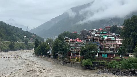

CHANDIGARH: For the first time, a comprehensive dam-break analysis and emergency action plan is being prepared by the Bhakra Beas Management Board (BBMB), with assistance from the ICED Centre of the Indian Institute of Technology (IIT), Roorkee, for a 135-km stretch of the Beas river across Mandi, Hamirpur and Kangra districts of Himachal Pradesh.
As part of the exercise, the stretch from Pandoh Dam in Mandi district to Dehra in Kangra district will be mapped, with vulnerable populations divided into three risk zones — Red, Blue and Green. The objective is to identify areas that could be affected by sudden water releases from the dam, flash floods, cloudbursts or other extreme weather events.
Sources said that under the proposed plan, the around 135-km stretch of the Beas river will be mapped and vulnerable populations divided into three risk zones. The Red Zone will cover areas that could potentially be inundated if exceptionally large quantities of water have to be released due to flash floods, cloudbursts or other extreme weather events. The Blue Zone will include locations that could face a threat in the event of higher-than-normal water releases from Pandoh Dam, while the Green Zone will comprise areas where water is expected to remain within the normal range.
Sources said identifying vulnerable areas and residents would significantly improve emergency preparedness. As part of the mechanism, the BBMB plans to collect the mobile phone numbers of people living in identified vulnerable areas and create a dedicated database so that emergency alerts, warnings and other messages can be sent during critical situations.
Besides residential houses, other properties falling within potential inundation zones will also be identified. The mapping exercise will enable local administrations to identify potentially affected populations and evacuate residents to safer locations well in advance. People will also be alerted about impending threats. The district administrations of Mandi, Hamirpur and Kangra will be informed before water is released from the dam.
The exercise is expected to provide a structured framework for communication, warning and evacuation in the event of sudden water releases or extreme weather conditions. The draft report is expected to be ready within six months.
An officer said the proposal is being implemented in three parts. The first has already been completed, while work on the second component is underway based on the initial findings.
