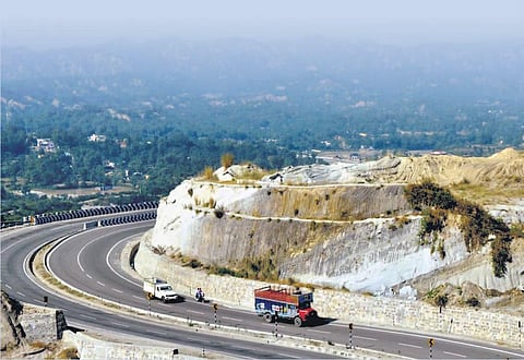
NEW DELHI: India’s vast network of national highways is poised for a technological makeover as the Union highways ministry has speeded up the process of completely mapping roads with geographic information system (GIS) by July 31.
The ministry of road transport and highways (MoRTH) has asked all the state and Central agencies engaged in developing and maintaining roads to coordinate with its regional offices so that field surveys can be conducted to update and verify details of the mapping done so far.
The mapping is being done by the Bhaskaracharya National Institute for Space Applications and Geo-informatics (BISAG-N), Gandhi Nagar. GIS maps contain detailed visual representation of data including location, topography, facilities and structures, and images. Besides, these maps can be easily added to various mobile apps and shared.
Officials said GIS mapping of the entire NH network is one of the most important requirements for planning, executing and monitoring the network but the task has not been completed so far and hence, a target of July 31 has been set.
According to the ministry, BISAG-N has already done GIS mapping of approximately 1. 30 lakh kilometres of NHs but it requires updates and verification. The field units of the National Highways Authority of India (NHAI) in coordination and support of BISAG-N are verifying the details but the field units of the ministry and other agencies such as state public work department (PWD), road construction department (RCD), Border Roads Organisation (BRO), and National Highways and Infrastructure Development (NHIDCL) are also required to engage themselves with BISAG-N for the job, said the officials.
The regional offices of the ministry have also been requested to coordinate with field units of other executing agencies to depute suitable personnel to get the details of all NH sections checked and mapped. They will also ensure availability of details with field units of respective executing agencies for ready reference.
Modern network
GIS maps contain detailed visual representation of data including location, topography, facilities and structures, and images. Besides, these maps can be easily added to various mobile apps and shared
Mapping done by Bhaskaracharya National Institute for Space Applications and Geo-informatics (BISAG-N), Gandhi Nagar
1.41 lakh km Total length of NHs in the country as of November 2021
1.30 lakh km Mapping already completed