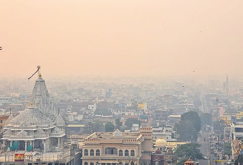

NEW DELHI: The India Meteorological Department (IMD) has predicted dense to very dense fog during the night and early morning hours over parts of northwest region, including Punjab, Haryana-Chandigarh, and Himachal Pradesh, in the late night or morning hours in the next 3-4 days, which may disrupt transport and aviation operations.
A low pressure area is likely to form over the southeast Bay of Bengal around November 23, which may intensify into a depression over the southwest in next two days. “It will cause heavy spell of rain over south Peninsular India. Further, a spell of very dense fog in the Northwest region will also disrupt transport and aviation operations in the Northwest region,” the IMD said in statement on Wednesday.
According to the IMD, an upper air cyclonic circulation is likely to form over south Andaman Sea and adjoining areas that may move northwestwards and become a low pressure area over southeast Bay of Bengal around November 23. “Thereafter, it is likely to continue to move west-northwestwards and intensify into a depression over southwest Bay of Bengal during subsequent two days,” it said. “A continuous watch is being maintained for further intensification and movement of the system towards Tamil Nadu-Sri Lanka coasts,” the statement said.
IMD advised taking of precautionary measures during foggy days to avoid road traffic collisions and chances of power lines getting tripped in the dense foggy routes. The Met department also advised people with lung-related illness to avoid exposure to fog “as it contains particulate matter and other pollutants.”
In case of exposure to fog, these particulate matters get lodged in the lungs, clogging them and decreasing their functional capacity, which increases cases of wheezing, coughing and shortness of breath.
“Long exposure to dense fog may cause respiratory problems for people having asthma bronchitis and other lung-related health problems. It will irritate membranes of eyes causing various infections, leading to redness or swelling of the eye,” the statement said.
The advisory to southern Indian states, such as Tamil Nadu , and Puducherry, says cyclonic storms will cause localised flooding of roads and water logging in low-lying areas.
Further, in its agromet advisories, the IMD directed Tamil Nadu to provide adequate drainage facilities for the removal of excess water from rice, cotton, sugarcane, turmeric and vegetable fields, coconut and banana orchards. Regarding Kerala, it advised proper drainage in rice, ginger and vegetable fields. It also called for providing mechanical support to banana plants to prevent lodging in Tamil Nadu and Kerala.
Meanwhile, the IMD has forecast the formation of a low-pressure area over the southeast Bay of Bengal around November 23, which could influence weather conditions in surrounding regions.
The Andaman and Nicobar Islands are expected to receive light to moderate rainfall throughout the week, with isolated heavy rainfall in the Nicobar region on November 22 and 23.
In the northeast, Assam and Meghalaya may experience light to moderate rainfall with isolated hailstorm activity on November 20. Nagaland, Manipur, Mizoram, and Tripura are likely to see similar weather from November 20 to 22.
Prediction for northwest
Low pressure over southeast Bay of Bengal around Nov 23 possibly intensifying into a depression over southwest in the next two days
Cyclonic storms to cause localised flooding of roads, waterlogging in low-lying areas of Tamil Nadu, Puducherry, Karaikal
Very dense fog in the late night or morning hours over Northwest India during the next 3-4 days