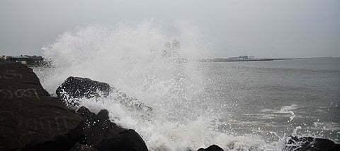

VISAKHAPATNAM: The developing weather system over the Bay of Bengal is likely to intensify into the first cyclonic storm of the year over the region by October 26, and move towards the Andhra Pradesh coast, reaching the west-central Bay of Bengal near the coast around the morning of October 28, the India Meteorological Department (IMD) has forecast.
The system, currently a well-marked low-pressure area over the east-central and adjoining southeast Bay of Bengal, is set to intensify into a depression on Saturday, followed by a deep depression on Sunday. It is likely to develop into a cyclonic storm by Monday morning as it moves west-northwestwards.
The Meteorological Centre, Amaravati, has issued a pre-cyclone watch for Andhra Pradesh, and adjoining south Odisha coasts.
While the system’s movement and intensity will become clearer as it develops, the forecast points to a spell of heavy rainfall and strong winds across Coastal Andhra, particularly on October 27 and 28.
Rainfall activity is expected to be relatively limited on October 25 and 26, with light to moderate rain forecast at isolated places across coastal Andhra and Rayalaseema. Winds may reach 40-50 kmph, with gusts up to 60 kmph, on October 26.
For Visakhapatnam and neighbouring districts, the latter half of the forecast period warrants close attention.
The IMD has predicted scattered heavy to very heavy rainfall, with extremely heavy rain at isolated places across parts of coastal Andhra on Tuesday and Wednesday.
On October 27, extremely heavy rainfall is likely at one or two places in Krishna and Bapatla districts. Heavy to very heavy rain is forecast in East Godavari, West Godavari, Eluru, NTR and Guntur districts.
Visakhapatnam, Anakapalli, Alluri Sitarama Raju, Srikakulam, Vizianagaram, Kakinada and several other coastal districts are also likely to receive heavy rainfall.
The rainfall outlook for October 28 indicates a wider area of concern. Extremely heavy rain is likely at isolated places in Visakhapatnam, Alluri Sitarama Raju, Anakapalli, Kakinada, BR Ambedkar Konaseema, East Godavari, West Godavari, Eluru, NTR, Krishna, Guntur and Bapatla districts. Heavy to very heavy rainfall is forecast in Srikakulam, Parvathipuram Manyam and Vizianagaram districts, while Palnadu, Prakasam and Sri Potti Sriramulu Nellore are under a heavy rainfall warning. The system is also expected to bring strong winds along the coast. Gale winds reaching 70-80 kmph, with gusts up to 90 kmph, are likely at isolated places in coastal Andhra on October 27 and 28.
Rayalaseema is likely to experience winds reaching 40-50 kmph, gusting to 60 kmph, during the same period.
People in coastal districts have been advised to follow official weather bulletins and local administration advisories. The sea condition is likely to remain rough over the east-central and adjoining southeast Bay of Bengal until the morning of October 25.
Conditions are expected to deteriorate from October 25, with very rough to high seas over the central and adjoining southeast Bay of Bengal,followed by high to very high seas over the west-central area of Bay of Bengal from October 26 to 28.
