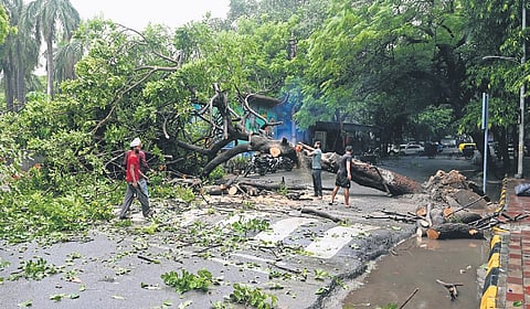

NEW DELHI: The city recorded the wettest day of August this year on Thursday, offering respite from the humidity. Several parts of the city witnessed heavy rainfall, inundating roads, triggering widespread traffic snarls and waterlogging, and bringing a sharp drop in temperatures.
According to the India Meteorological Department (IMD), Lodi Road recorded the highest rainfall between 8.30 am and 5.30 pm at 60.4 mm, followed by Safdarjung at 56.0 mm, Ridge at 54.4 mm, Ayanagar at 22.3 mm and Palam at 14.6 mm. The cumulative rainfall recorded since 8.30 am stood at 43.8mm at Lodi Road, 25.2mm at Palam, 18.7mm at Safdarjung, 17.2mm at Ridge and 14.2mm at Ayanagar, the IMD said.
The rainfall brought down the maximum temperature significantly, with Safdarjung, the city’s base station, recording a maximum of 27.6 degrees Celsius, 6.6 notches below normal. Lodi Road recorded 27.8 degrees Celsius, 5.2 notches below normal; Palam, 27.3 degrees Celsius, 7.1 notches below normal; Ridge, 27.6 degrees Celsius, 6.4 notches below normal; and Ayanagar, 27.2 degrees Celsius, 6.8 notches below normal.
The weather office has forecast a generally cloudy sky with heavy rain on Friday and issued a yellow alert for the capital. Temperatures are expected to range between 27°C and 30°C, accompanied by high humidity levels around 91%.
In many areas roads were submerged and traffic movement was severely disrupted for hours. Waterlogging was reported from Sainik Farms, Shastri Park, Rohtak Road, Tughlaqabad, near the Red Fort and parts of ITO.
Mahesh Palawat, vice president (Meteorology and Climate Change) at Skymet Weather, said Delhi and adjoining areas are likely to receive moderate rain over the next two to three days under the influence of multiple weather systems.
He noted that a western disturbance over the Himalayas, cyclonic circulations over UP, Bihar and the Darjeeling region, an active monsoon trough and enhanced moisture incursion from the Bay of Bengal are expected to keep rainfall activity over north India active.
He said, the systems are likely to bring widespread rainfall across the Indo-Gangetic plains, with heavy rainfall likely in some areas. Delhi is expected to receive light to moderate rain till August 10.
The city’s air quality was recorded in the “satisfactory” category yet again at 4 pm.
Today’s temperature
The IMD has forecast a generally cloudy sky with heavy rain on Friday and issued a yellow alert for the capital. Temperatures are expected to range between 27°C and 30°C, accompanied by high humidity.
NHAI told to resolve NH24 flooding: PWD minister
PWD Minister Parvesh Sahib Singh on Thursday directed NHAI to raise the road level to resolve recurring waterlogging problems on NH 24. Singh has also directed NHAI to submit detailed reports on recurring waterlogging spots.
