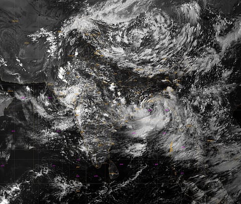

BHUBANESWAR: With incessant rains lashing Odisha for the last two days after a low pressure system intensified into a depression, the India Meteorological Department (IMD) has issued a low to moderate flash flood risk warning for Cuttack, Khurda, Puri and 24 other districts till Monday morning.
The weather system dumped extremely heavy rainfall (204.5 mm or more) at two places in the last 24 hours ending at 8.30 am on Sunday. Biridi in Jagatsinghpur district received the maximum of 330 mm rainfall followed by Sambalpur’s Jujumura at 270 mm.
Four places recorded very heavy rains (115.6 mm to 204.4 mm), Balipatna in Bhubaneswar being one of them, witnessing 130 mm showers between Saturday and Sunday morning. A total of 54 places in the state received heavy rains (64.5 mm to 115.5 mm) during this period. The state received 30.8 mm rains in the last 24 hours, a departure of 151 per cent.
On Sunday, heavy rainfall continued with Kendrapara and Sonepur recording 78 mm and 71 mm rains respectively between 8.30 am and 5.30 pm. Under the influence of the system, extremely heavy rainfall may occur at one or two places in Sundargarh, Keonjhar and Mayurbhanj districts and very heavy rainfall at a few places in 15 districts including Cuttack on Monday.
The IMD informed that the depression over northwest Bay of Bengal and adjoining areas of north Odisha-West Bengal coasts moved northwestwards and lay centered at 11.30 am on the day over the same region, about 90 km south of Sagar Island (West Bengal), 110 km southeast of Digha, 150 km east of Chandbali and 150 km east-southeast of Balasore.
The system is likely to move northwestwards, intensify further into a deep depression during the next 24 hours and cross north Odisha and West Bengal coasts between Paradip and Sagar Island around Monday noon, it said.
As the system is expected to trigger heavy rains in Chhattisgarh too, the authorities here are keeping a close watch on the possible flood situation in Odisha.
