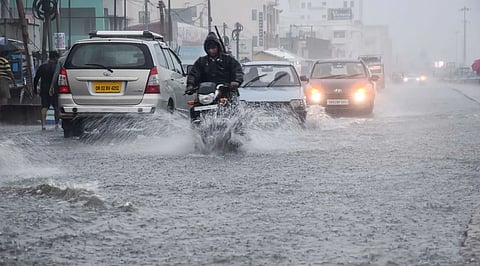

BHUBANESWAR: The unprecedented rainfall in Ganjam district and the subsequent floods have caught meteorologists and the Odisha government off guard. And there is a reason for that.
The 546 mm rainfall recorded at Patrapur in Ganjam was the fourth-highest 24-hour precipitation recorded in Odisha between 1988 and 2026. even the Super Cyclone on 1999 had not brought in such downpour.
The highest was a mind-boggling 825 mm recorded at Thuamul Rampur block in Kalahandi district on July 28, 1991. Karlamunda in the same district reported a massive 608 mm on August 13, 2019. A day later, on August 14, Balangir town recorded 555 mm of rainfall.
According to data on 314 rainfall incidents over the 38year period between 1988 and 2026, Ganjam has recorded 22 such occurrences. On Wednesday (October 29), five of its rain gauge stations recorded 261 mm or more rainfall.
Interestingly, nine of the highest rainfall incidents during this period were recorded on October 29, 1999, the day the Super Cyclone ripped through the Odisha coast, leaving the state in tatters. Ten days before the Super Cyclone, a mini cyclone had hit Ganjam district on October 18, 1999. The district had recorded heavy rainfall then as well.
Associate professor at the School of earth, Ocean and Climate Sciences, IIT Bhubaneswar, Sandeep Pattnaik said Arnab was a unique cyclonic storm as its core cloud band, which hit Kakinada, remained stationary for a considerable period in the absence of a trough axis from the northwest. This was why Ganjam and Gajapati bore the brunt of the storm.
“The northeastern sector of the system witnessed intense cloud formation due to strong moisture convergence. This cloud band moved towards Ganjam, Gajapati and Kandhamal, where the presence of the eastern Ghats amplified the rainfall through the orographic effect,” he said.
A similar interaction between the cyclone’s cloud bands and the eastern Ghats had a catastrophic impact on Gajapati, one of the worst-affected districts during Cyclone Titli in 2018 as well.
However, the floods cannot be attributed to rainfall alone, Pattnaik said. Water management, dam operations and solid waste management are among the other factors contributing to the situation.
“Our drainage systems, dams and embankments are struggling to withstand such extreme rainfall. This is not limited to Odisha. We have witnessed similar situations in Chennai and Mumbai, besides recurring incidents in Uttarakhand. The impact of climate change is unfolding much faster than anticipated, and we are not prepared for it. We are also allowing people to settle in catchment areas, which is a major concern,” he said.
Engineer-in-chief of the Water Resources department Dillip Kumar Rout said water levels in dams in the region had already been brought down to around 60 per cent of their capacity, against the usual 75 per cent, in view of the cyclone alert.
“The rainfall was extreme. The water level of the Rushikulya reached 19.2 metre, surpassing the danger mark of 17 metre, in no time,” Rout said.
B Anjan Kumar Prusty, professor and head of the department of environmental Science at Berhampur University, said the topographical features of Ganjam and Gajapati make the districts particularly vulnerable to extreme weather events.
In Ganjam, the Kandhamal and Patrapada-Jarada hill systems contribute to the orographic effect. The narrow coastal plain also leaves little distance between the coast and the hill ranges, resulting in increased condensation and rainfall as cyclonic systems move inland. Stormwater also has inadequate space to drain into the sea or percolate into the ground, largely due to large-scale construction and the shrinking of natural drainage channels.
Rivers such as the Rushikulya and Bansadhara require deltaic floodplains to accommodate excess water. Several low-lying areas, including parts of Berhampur, are naturally part of these floodplains. Construction in such areas obstructs the natural flow of water and prevents groundwater recharge, leading to artificial flooding and waterlogging even during normal rainfall, he said.
“We are strategically killing our wetlands through land settlements, encroachment and the shrinking of their areas in the name of development. Our response to such crises has to be based on an ecological engineering model rather than an urban engineering model,” Prusty said.
An official of the Meteorological Centre, Bhubaneswar, said the flood situation could have been better managed had water been released from dams in Ganjam after heavy rainfall alerts were issued well ahead of the cyclone.
