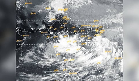
CHENNAI: The regional meteorological centre on Tuesday stated that a low-pressure area, formed over the northwest Bay of Bengal off the Odisha coast, is expected to intensify over the next 48 hours.
Several districts in the state, especially those in the southern region, which have already received above-normal rainfall due to a low-pressure system in the Arabian Sea, may receive more rain until May 30.
The low-pressure area is likely to move slowly northwards towards Bangladesh and Myanmar over the next few days, during which time Tamil Nadu is expected to receive significant rainfall. There may be a break in rainfall activity from June 1.
An orange alert has been issued for the ghat areas of Coimbatore, Tirunelveli, Tenkasi, Theni, and Nilgiris districts, where heavy to very heavy rainfall is expected. Tiruppur, Dindigul, and Kanniyakumari may experience heavy rain.
‘State got 96% excess rain from Mar 1 to May 27’
Overall, Tamil Nadu has received 96% excess rainfall from March 1 to May 27. According to the IMD forecast, Tamil Nadu is expected to receive above-normal rainfall during the ongoing southwest monsoon, and daytime temperatures in June are also likely to remain below normal.
The early arrival of monsoon and thunderstorm activity has significantly eased the harsh summer, with Chennai stopping short of breaching 40 degrees Celsius this year. Data show that mercury has been below normal during most of May, the peak summer month.
On Tuesday, the Meenambakkam weather station recorded a temperature of 35.2 degrees, which is 4.6 degrees below normal. The usually blazing Dharmapuri, Tiruttani, and Vellore regions have recorded daytime temperatures close to 6 degrees below normal.
In the last 24 hours ending 8.30 am on Tuesday, Avalanche in Nilgiris received the highest rainfall of 26cm, followed by Emerald station in the same district, which received 13cm. Upper Bhavani in Nilgiris and Chinnakala in Coimbatore recorded 12cm each.
With the continuous heavy rain in the Nilgiris, a total of 17 houses have been partially damaged. As many as 275 persons have been shifted to temporary shelters as part of precautionary measures so far in the district, said Nilgiris MP A Raja on Tuesday. The rain, however, subsided on Tuesday.
Raja said that they are conducting a study to assess the damage caused by the rain, and steps will be taken to provide compensation to the affected farmers in the district.
“Along with the existing National Disaster Response Team, nine more teams are ready in Coimbatore, Tirupur and Mettupalayam in case of rain and flooding,” said Raja.
The MP has also appealed to the people of the Nilgiris not to panic as the district administration is well-prepared to handle the situation.
Raja and TN Assembly Chief Whip K Ramachandran handed over Rs 8,000 to the owners of partially-affected houses and Raja’s own contribution of Rs 10,000 to each family.
Meanwhile, Deputy Chief Minister Udhayanidhi Stalin reviewed preparedness in Chennai and the surrounding regions on Tuesday for the southwest and northeast monsoons. Udhayanidhi reviewed stormwater drain works, and the precautions in place at areas affected by flooding during the northeast monsoon last year, according to a release.
(With inputs from Chennai and Coimbatore)