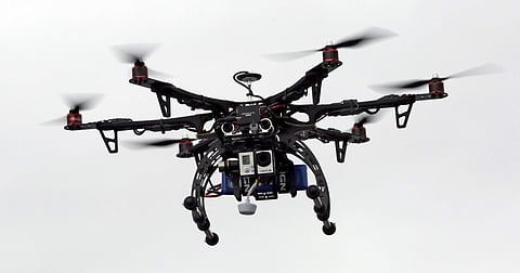

NEW DELHI: The Delhi Development Authority (DDA) has begun Geographic Information Systems (GIS) mapping of land parcels being offered by individuals under its ambitious land pooling scheme. The agency is also using drones for the purpose.
A pilot project, the agency is carrying out drone survey for mapping of land, registered so far, in zone N, which shares its boundary with neighbouring Haryana.
Several villages such as Kanjhawala and Bawana fall under zone N. The work for drone survey has been awarded to IIT Roorkee and Survey of India. A senior DDA official said zone N was chosen for the pilot project because a large chunk of land for the scheme was registered in this sector.
“The data collected through the drone survey will assist in prevention of unauthorised transactions as well. Based on the result of the survey, a similar method may be used for mapping other zones. The survey is expected to finish the task at the earliest and yield better results. This will also help us prepare digital statistic,” said the official, aware of the matter.
Earlier, the Delhi government planned to use drones for mapping boundaries of unauthorised colonies. Two agencies were roped in to undertake the survey of 893 unauthorised colonies. However, the project failed.
Besides Kanjhawala and Bawana, the DDA has registered huge parcels of land in Qutubgarh, Sawda Ghera, Bakhtawarpur and Sultanpur Dabas under its land pooling policy.
In February, the land owning agency launched a single-window online portal for inviting registration for land pooling. Initially, the response wasn’t encouraging but land owners started registering gradually.
The last date for registration was extended till September 6, said an official of the DDA. The original deadline was August 4.
Till August 4, an estimated 4,452 hectares was registered, of which about 23 % was deemed developable area. According to the DDA, under the five zones, around 34,180 hectares is available for land pooling.
The officials said GIS mapping through drone survey might also be used for preparing Master Plan for Delhi 2041 to ensure a better planning exercise. “The drone survey will help us get accurate maps. We will know how much land is under agriculture and has constructions,” he said.
The land pooling policy was in October last year with an aim to built nearly 17 lakh houses, including five lakh, for the economically weaker sections.
IIT-Roorkee, Survey of India on the job
The work for drone survey has been awarded to IIT Roorkee and Survey of India. A senior DDA official said zone N was chosen for the pilot project because a large chunk of land for the scheme was registered there