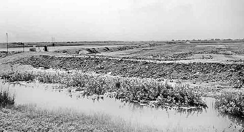

Destruction of mangroves which is continuing unabated in Krishna district in the absence of protective measures by the government is posing threat to the ecological system.
It has also become a major cause of concern for the people living in the coastal areas as the mangroves act as natural protectors to control the cyclonic winds and tsunami waves.
According to information available with the forest department, the total area of the land that comes under the Coastal Regulation Zone (CRZ)- area up to 500 meters from the high tide of the sea - is 90,000 acres along the 123 km long coastline in Krishna district.
A major portion of the land that falls under the CRZ was covered by the mangroves. But the mangrove plantation was reduced to only 17,000 acres, according to a survey by the forest department that was done four years ago.
Meanwhile, it is alleged that the area of the mangroves has even reached to a mere 4,000 acres in the recent times due to digging of the fish ponds by the ‘land mafia’ that enjoys both political and officials’ support.
According to the sources, as many as 1,500 acres of land under CRZ was encroached upon by the ‘land mafia’ in Kruthivennu mandal alone. In this scenario, one can assess the situation in other coastal mandals including Nagayalanka, Koduru, Machilipatnam and Bantumilli.
A fisherman from Laxmipuram of Kruthivennnu mandal, Varadarajulu, has alleged that either the forest officials or the revenue officials were not serious in their efforts to check the encroachments under CRZ limits due to political pressure as well as enticement by the mafia.
However, speaking to Express, DFO (Eluru) T Srinivasa Rao said that they were taking all measures for the protection of the mangroves and had also prepared plans to grow mangroves in as many as 1,818 acres in Avanigadda area soon. “A survey to identify the illegal encroachments is going on, we are also removing the encroachments,” he added.
According to a satellite survey on wetlands done and published in 2011 by Union ministry of environment, the mangroves of Krishna delta occupy an area of around 68,351 acres. The second largest patch of mangroves in AP, the Krishna river emerges from the hills at Vijayawada, flows for about 96 km downstream by forming a delta before it eventually empties into the sea.
The Hamsaladeevi distributary is the first to branch out 60 km downstream from Vijayawada near Avanigadda and flows northward into the sea near Machilipatnam. Mangroves have been reported to be less abundant there. The Gollamattapaya and Nadimeru distributaries branch out 25 km downstream from Avanigadda and join the sea.
The main Krishna channel flows southward to join the sea near false Divi point. The abundance of mangroves is more along the main Krishna river than the other distributaries. Mangroves are mainly prevalent around these three distributaries. Thirty two species of mangrove and mangrove-associated plants belonging to 26 genera and 18 families are recorded in Godavari and Krishna mangrove ecosystems.