‘Satellite imagery can monitor and reduce carbon emission’
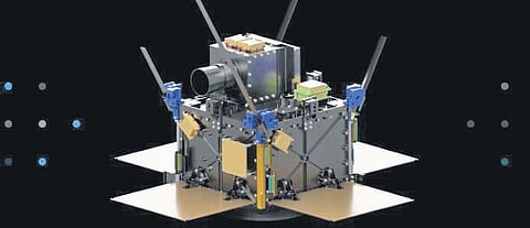
CHENNAI: Space tech startup Pixxel Space believes that its high-resolution satellite imagery and analytics tools can help companies monitor and reduce carbon emissions and regulate pollution. The satellites can monitor emissions at scale and help in the environment, social and governance (ESG) reporting of companies, chief executive officer and founder of Pixxel Space Awais Ahamed said.
“Greenhouse gas emissions, pollution, its quantity can be measured at factories and could be checked whether polluted air emitted above the city, pollutants are mixed in the water bodies and rivers. We can find oil, and gas leaks from pipelines and industries,” he said. It has also developed analytics models which can measure the impact of oil, gas exploration, and mining operations and have developed alternative geo-spatial-based methods to explore oil, coal with minimal impact on the environment.
The startup is also focussing on assessing soil and water health. Pixxel Space’s prediction of crop yields is considered to be a primary use case. “With the hyperspectral imagery, we can identify the crops species among greenery, identify pesticide and other problems in the crops and predict yields,” Kshitij Khandelwal, founder and chief technical officer of Pixxel Space.
In an interaction with this newspaper, he said, “With the mixed cropping pattern in India, we can find out crop species, crop health. We can analyze whether, the crop that will need fertilizer or predict the yield at an area using machine learning models.”

