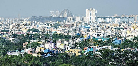

CHENNAI: Chennai's new master plan, which is now being prepared by the Chennai Metropolitan Development Authority (CMDA) with technical assistance from the World Bank, will focus on reducing the impact of natural disasters due to climate change.
The Second Master Plan of Chennai which has been drawn up for the period till 2026 did not focus on disaster and climate resilience of the city. CMDA has started the groundwork for the new master plan by seeking a GIS expert and climate resilience and environmental specialist to devise a roadmap for urban growth of the city till 2046.
Chennai's Second Master Plan was prepared to provide regulations for development and building activity in the city. It envisages a population of 58 lakh for Chennai city and 126 lakh for Chennai Metropolitan Area (CMA) by 2026. But with the proposed city limits being expanded from 1,189 sqkm to 8,878 sqkm, will the masterplan have to take into account proposed urban growth in the new areas?
Former Anna University professor of urban engineering K P Subramanian, who had opposed the CMA expansion, told The New Indian Express that the new masterplan could not include the proposed expansion as the provisional notification had lapsed.
Official sources said the preparation of the master plan for Chennai is part of the Tamil Nadu Housing and Habitat Development Project (TNHHDP), a World Bank financed project of the state government. A total of USD 9 million up to the financial year 2023-24 has been approved by the World Bank for the CMDA as part of the project, a source said.
The technical assistance from the World Bank includes a climate and disaster resilience study and geo-spatial mapping to feed into the master plan preparation process, as well as undertaking analytics on river drainage basin and flood plain mapping.
This would include support to development of a comprehensive vision for future urbanization of Chennai plugging into and supporting the proposed Chennai City Partnership program (another project proposed to be financed by the World Bank).
The focus of the new master plan will be to strengthen urban planning systems including supporting the preparation of guidelines that support the master plan process. It also includes capacity building towards establishing modern and inclusive land use planning systems and twinning with an international city on metropolitan planning functions.
A source said the GIS expert will be part of the Project Implementation Unit (PIU) set up at CMDA, whose role would include implementing the GIS roadmap prepared as part of the Master Plan Process and Capacity Study. The new master plan will include a metropolitan growth vision for the Chennai Metropolitan Area, including establishing a geo-spatial platform towards preparation of land use planning. This will focus on increasing the affordability of housing and building capacity of the institution to coordinate and aggregate multi-sector spatial information towards preparation of the master plan.
K P Subramanian said that the new master plan should do away with conventional planning which used to focus on land use planning only. The focus of the third master plan should be on creating infrastructure and then on development. "Usually, the focus is on development and then on infrastructure and this has created chaos," he said.
Interestingly, the Second Master Plan has been a contentious issue, with builders, planners and academicians faulting it. As per the norm, it should have been reviewed every five years but planners in the CMDA have hardly done so since it was implemented in 2010.
While the First Master Plan and Second Master Plan projected a total increase in built-up area by 330.58 sqkm (33,058 hectares) over the 50 year period between 1976 to 2026, the actual increase in built-up area as worked out using satellite imageries over 37 years period between 1979 and 2016 was 450.26 sqkm pointing to large-scale illegal constructions.
The fault lies in the state government not enacting the Flood Plain Zoning (FPZ) mandated by the Central Water Commission which in 1975 circulated a model bill for it. Even the Second Master Plan prepared by CMDA’s planners did not provide for FPZ, a concept to regulate land use in the flood plains to restrict the damage caused by floods and determine the locations and extent of areas for developmental activities so that it does not affect the environment.