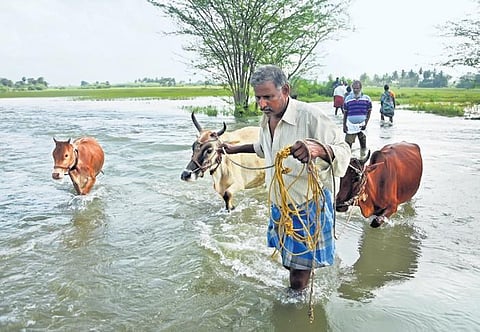

CHENNAI: It has been a week since the rains stopped but lakes in and around Parandur, the proposed site for the second airport for Chennai, continue to overflow and hundreds of acres of paddy remain marooned.
For 80-year-old K Manohar, who owns four acres of land in Ekanapuram, losing his crop is not an immediate concern. He is more worried about losing his land to the project. The State has identified over 4,500 acres in Kancheepuram and Sriperumbudur taluks spread across 13 villages for the greenfield airport, including the whole of Ekanapuram revenue village which accounts for nearly 900 acres.
During a visit to Ekanapuram and surrounding villages, TNIE found out that at least 60% of the proposed site is flooded. Hundreds of cusecs of water are overflowing through the irrigation tanks and lakes. The villagers and experts warn that if this area is concretised for the airport and the waterflow matrix is altered, flooding would worsen.
An open letter to the Tamil Nadu State Disaster Management Authority by a group of citizens and environmentalists, including Mohan Ranganathan, an aviation safety consultant who was part of the Airport Authority of India (AAI) inspection team for Parandur in 2008, called the proposed airport project “a recipe for disaster”.
The letter said as per a study conducted by the Interdisciplinary Centre for Water Research at the Indian Institute of Science, the release from Chembarambakkam reservoir was only 800 cusecs, whereas ‘the flood flow from the parallel catchment flowing from Manimangalam, Perungalathur and Tambaram may have contributed as much as 3,000 m3/s.
Together, the flood at its peak when it entered the city has been estimated to be about 3,800 m3/s (1,34,195 cusecs), whereas the flood-carrying capacity of Adyar river is only about 2,038 m3/s (72,000 cusecs)”. In other words, the southwestern catchment, which includes the Parandur airport site, alone contributed 3000 m3/s to the Adyar.
This report forms part of the Comptroller and Auditor General’s report on the 2015 Chennai floods. SD Kathiresan, who is leading the protests against the project said if the proposed airport is built it will obstruct the flow of the 43-km Kamban canal which fills 84 lakes before emptying into Chembrambakkam. “About seven km of Kamban falls inside the proposed airport site. Here there is no tradition of using pump sets and farmers are purely dependent on water from lakes. It is an age-old and well-established irrigation network. If the government disturbs this, it will have a cascading impact both in terms of flooding and food security.”
As per a report released by Poovulagin Nanbargal, a Chennai-based environmental organisation, around 1,317 acres of 4,563.56 acres to be acquired for the airport are classified as poramboke land. Out of this, nearly 955 acres are covered by lakes, ponds, and small waterbodies.
S Krishnan, additional chief secretary to the government in the industries department, told TNIE: “We are in the middle of the monsoon and waterbodies will be overflowing. Yes, a part of Kamban canal falls within the proposed airport area. A detailed hydrological study will be conducted. All views will be accounted for before taking any decision. We understand the need to strike a balance while designing and developing any project.”