CHENNAI: The State government has launched ‘Tamil Nadu Digital Forests’ project to take stock of all the valuable forest resources, and digitise the forest boundaries to identify and curb encroachments.
Environment Secretary Supriya Sahu, who passed the G.O., said the objective was to develop a strong, centralised repository of geo-spatial database, which is accurate, authentic and transparent. “The initiative will help in making evidence-based decisions whenever a project comes for approval,” she said.
As per the project proposal submitted by Principal Chief Conservator of Forests (Head of Department) Ashok Upreti, the forest department intends to carry out a DGPS survey to prepare necessary geo-databases with boundary details, and strengthen the IT infrastructure using artificial intelligence, blockchain technology and cloud computing etc.
The government has accorded administration sanction of Rs 33.10 crore for the project’s implementation. A senior forest official told TNIE this was a crucial initiative considering there is a lot of ambiguity and inconsistencies in terms of forest boundaries, which result in encroachment of forest land and pile-up of project files that seek no-objection certificate.
“If there is a central repository of geo-spatial database, where boundaries of every reserve forest, wildlife corridors, eco-sensitive zones, wetlands and zones of influence are digitally demarcated, then it becomes seamlessly easy to delineate and make informed decisions,” the official said.
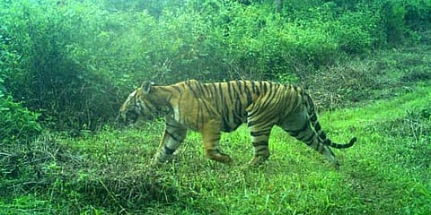
For instance, when the India-based Neutrino Observatory (INO) project was proposed in Bodi West Hills in Theni, it wasn’t even reported by forest officials that the site was falling inside the designated Mathikettan-Periyar tiger corridor.
“Only recently did we realise it and raised objections, stalling the project. This kind of situations can be avoided if we have digital maps of forest boundaries for reference. Likewise, there are resorts and quarries operating inside forest areas.” The G.O. says the project will also help in real-time monitoring of incidents like forest fires, wildlife depredation, plantation activities, wildlife corridors, and in reporting human-wildlife conflict.