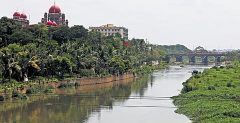
HYDERABAD: The Musi Riverfront Development Corporation Limited (MRDCL) will commission a photorealistic 3D digital twin modelling exercise of existing built structures along the Musi River, covering a 1-kilometre corridor on either side of the river for two stretches, Osmansagar to Bapughat and Himayathsagar to Bapughat. The combined river length is 21 km, giving a total modelling area of 42 sq km (21 km × 2 km).
Constituted by the state government as a special purpose vehicle for pollution abatement and riverfront development, MRDCL is the nodal agency responsible for preparing and executing the comprehensive plan and will coordinate activities with GHMC, HMWSSB and HMDA for abatement of Musi River pollution and riverfront development.
The project will be taken up at an estimated cost of `14.7 lakh, and the completion period is approximately three months from the date of award.
Sources said the 3D mesh generation will be done using Skyline Photomesh technology to produce the final digital twin output in the .3DML format. The solution must be capable of processing multi-angle (five-camera) oblique imagery.
The final 3D model must achieve a photorealistic representation of the urban environment and maintain geometric accuracy suitable for planning and visualisation.
The selected agency must carry out a thorough assessment of pre-acquired multi-angle oblique imagery, including evaluation of image quality, coverage completeness and metadata integrity. It must also analyse ground sampling distance to confirm adequate resolution, organise and catalogue the image dataset, and extract and verify metadata. Initial quality screening to identify problematic images, as well as a review of existing ground control points (GCPs) with recommendations for additional GCPs if needed, must be conducted.
Data processing includes comprehensive pre-processing of photo data and implementation of the photomesh processing pipeline: aerotriangulation and camera alignment, dense point cloud generation, mesh construction with optimised triangle count and texture mapping from the original imagery.
The use of cloud processing infrastructure with scalable computing resources and parallel processing capabilities for large datasets is expected, along with automated quality checks throughout processing.
