Extending roughly 670 km along a south-west to north-east axis, the Aravalli Range stretches from the Delhi Ridge through southern Haryana and eastern Rajasthan into northern Gujarat, tapering out near Ahmedabad. Traversing over 20 districts across four states, it intersects some of India’s most densely populated, rapidly urbanising and environmentally fraught regions.
Though modest in elevation when set against younger orogenic systems, the Aravallis constitute a continuous and overlapping assemblage of landforms—ranging from prominent summits such as Guru Shikhar (1,722 metres) on the Mount Abu plateau, the highest point of the range, to extensive low hills, ridges, pediments, rocky outcrops and adjoining plains.
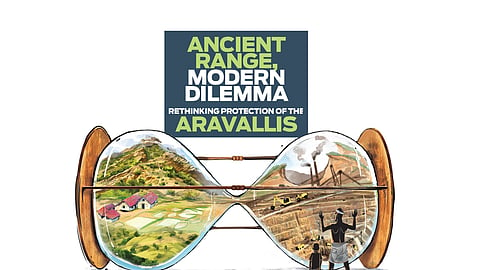
Recent administrative and judicial efforts to impose a narrow legal definition upon the Aravallis have revived debate not merely over juridical clarity, but over how ancient landscapes ought to be scientifically apprehended and institutionally governed. Any serious assessment must therefore be grounded in geological antiquity, long-standing human interaction, evolving legal treatment and demonstrable ecological function.
Geological history and comparative antiquity
The Aravalli Range ranks among the oldest surviving fold mountain systems on Earth, with an estimated age of 200–250 crore years, placing its genesis firmly within the Precambrian era. Its formation is associated with multiple tectonic episodes — most notably the Aravalli Orogeny (c. 200–180 crore years ago) and the Delhi Orogeny (c. 170–140 crore years ago)—involving collisions between ancient continental blocks within the proto-Indian craton. Over hundreds of crores of years, these once-towering mountains were subjected to relentless erosion and denudation, yielding the subdued and pockmarked relief visible today.
This deep antiquity is emphasised by the presence of the Bhilwara Gneissic Complex, among the oldest exposed continental crustal formations in the Indian subcontinent. By contrast, the Vindhyas consist largely of sedimentary deposits laid down between roughly 160 and 60 crore years ago; the Satpuras emerged primarily between 60 and 30 crore years ago; and the Himalayas remain geologically youthful, having risen only in the last 5–6 crore years following the India–Eurasia collision.

Historical and civilisational context
Archaeological evidence attests to sustained human habitation across the Aravalli landscape from the Palaeolithic period onwards, including stone tools recovered from forested hill zones such as Mangar Bani. During the Chalcolithic era, river systems draining the Aravallis underwrote cultures such as the Ahar–Banas tradition (c. 3000–1500 BCE), which exploited copper ores and participated in extensive exchange networks linking western and northern India.
In subsequent historical phases, the Aravalli uplands functioned as inland corridors connecting the Indo-Gangetic plains with western India. Their rugged terrain was strategically instrumental, as reflected in fortified complexes such as Kumbhalgarh. Across epochs, the range decisively shaped settlement patterns, mobility, trade routes and resource use, embedding itself in the civilisational geography of the subcontinent.
Hydrological and climatic role
The Aravalli Range functions as a critical hydrological reservoir and climatic moderator for north-western India. Composed largely of fractured quartzites and schists, its ridges and hill systems facilitate deep rainwater percolation, rendering the range a major groundwater-recharge zone identified by the Central Ground Water Board.
Historically, the range also mitigated desertification by disrupting wind regimes and constraining the eastward drift of sand and dust from the Thar Desert. Scientific assessments suggest that the Aravallis once enhanced orographic uplift and rainfall persistence; cumulative erosion, deforestation and extractive activity have progressively attenuated this function.
Evolution of legal and administrative understanding
For much of the colonial and early post-Independence period, the Aravallis existed in governance primarily as a geological abstraction rather than a legally circumscribed entity. While British-era surveys clearly delineated the range, post-Independence statutes—most notably the Indian Forest Act, 1927—applied only to formally notified forests, leaving scrublands, rocky ridges, pediments and commons beyond statutory protection.
The 1992 Aravalli Notification marked the first concerted attempt to regulate environmentally pernicious activities, particularly mining and construction. However, it conspicuously avoided defining what constituted an “Aravalli hill” or the “range” itself. This lacuna became the fulcrum of litigation from the mid-1990s onwards, as state authorities and private actors leaned on revenue records to misclassify mined areas as “plains”.
In M C Mehta versus Union of India in 2002, the Supreme Court prioritised ecological function over formal land classification, imposed mining bans in Haryana, and repeatedly cautioned against exploiting definitional ambiguity.
Subsequent jurisprudence, including the T N Godavarman line of cases, further expanded environmental interpretation beyond narrow legal labels.
With the establishment of the National Green Tribunal (NGT) in 2010, enforcement increasingly relied on satellite imagery, slope analysis and landscape-level assessment, consistently treating the Aravallis as an integrated geo-ecological system. Legislative dilution attempts—most notably Haryana’s amendments to the Punjab Land Preservation Act—were stayed on the principle that judicial environmental safeguards could not be legislatively undermined.
The Supreme Court’s 2024 constitution of an expert committee was intended to bring clarity. However, the 2025 adoption of a 100-metre local-relief criterion marked a departure from established ecological reasoning. Scientific submissions, including those by the Forest Survey of India, indicated that only 8–10% of landforms historically and scientifically recognised as Aravalli meet this threshold.
Consequently, nearly 90% of the existing Aravalli landscape — low ridges, shallow hills and rocky outcrops — stands excluded from formal legal recognition despite incontrovertible ecological significance.
Mining, quarrying and landscape transformation
The Aravallis have been subjected to extensive mining, quarrying and urban encroachment, particularly in eastern Rajasthan, southern Haryana and the National Capital Region.
Damage is disproportionately concentrated in low ridges and pediment zones—landforms frequently rendered legally invisible despite their hydrological and ecological centrality.
Drone-based surveys in Bhilwara district reveal systematic illegal mining extending far beyond sanctioned lease boundaries. In the Samodi and Pansal Dang regions, mining operations spanned roughly 64 hectares against approved leases of only 11 hectares. Official extraction figures of 24.66 lakh and 38.09 lakh tonnes were starkly contradicted by drone-based estimates of 51.9 lakh and 67.5 lakh tonnes, indicating illegal removal of approximately 57 lakh tonnes from just two sites. State data further records 2,096 illegal mining cases between 2020 and mid-2025 across 20 districts, with Bhilwara alone accounting for 514 cases.
A satellite-based assessment by Alok Raj and Laxmi Kant Sharma (2022) documents that between 1975 and 2019, nearly 8% of the Aravalli hills—around 5,772.70 sq km—were lost to mining and urban expansion. Of this, 3,676 sq km degraded into barren land and 776.80 sq km into settlements. The authors estimate degradation at 0.57% annually and warn that as much as 22% of the Aravalli system could vanish by 2059 if prevailing trends persist.
International evidence from comparable landscapes
Global experience demonstrates that mining in ancient, low-elevation mountain systems inflicts disproportionate and often irreversible harm. At Rosia Montana in Romania, sustained international scrutiny halted open-pit mining in a fragile upland landscape. In Myanmar’s jade-mining regions, extraction has triggered deforestation, landslides and livelihood collapse, while similar outcomes are documented in Malaysia’s bauxite belts and vulnerable Pacific uplands. These cases teach us a central lesson: elevation is a poor proxy for ecological vulnerability.
Internationally, mountains are increasingly conceptualised as ecological infrastructure. UNEP promotes integrated watershed management and community-based conservation.
Greenland has imposed precautionary bans on uranium mining in sensitive uplands, while European and North American regulatory frameworks prioritise hydrological and ecological function over altitude alone—reflecting a growing consensus in favour of precautionary governance for ancient landscapes.
Classification of a mountain from the lens of policy
Today’s debate about Aravalli Range is a classic case over how states govern ancient, fragile and functionally critical landscapes. Across jurisdictions, three broad governance paradigms recur: strict non-intervention, prohibition of commercial exploitation with regulated human use, and managed extraction under “sustainable development” frameworks.
The strict protection or near “no-intervention” model has been adopted where ecological systems are exceptionally old, slow to regenerate and central to wider environmental stability. The Galápagos Islands in Ecuador exemplify this approach: commercial mining, large-scale construction and extractive tourism are prohibited, not because humans are absent, but because ecological thresholds are irreversible once crossed. Similarly, Australia’s protection of the Tasmanian Wilderness World Heritage Area rests on the recognition that Precambrian and early Palaeozoic landscapes cannot recover on human time scales.
A second and more widely applicable model distinguishes sharply between human presence and profit-driven commercial intervention. The Andean páramo ecosystems of Colombia and Ecuador illustrate this approach. These high-altitude grasslands are legally protected from mining and oil extraction because they supply drinking water to major cities, even though pastoralism and indigenous land use continue. Colombia’s Constitutional Court explicitly ruled that commercial mining poses unacceptable risks to hydrological systems, while community use does not.
A comparable logic underpins the European Alps, where permanent settlements, agriculture and tourism coexist with strict limits on quarrying, mining and infrastructure that could destabilise slopes or aquifers.
These cases resonate strongly with the Aravallis, which have long supported human habitation without suffering the scale of damage unleashed by modern extractive and speculative capital.
The third paradigm—regulated commercial use under “sustainable development”—has proven the most contentious. The Appalachian Mountains in the United States offer a cautionary example. Despite elaborate environmental impact assessments, mountaintop removal mining led to irreversible hydrological damage, forest loss and public health impacts, prompting growing regulatory bans at the state level. In Indonesia’s Papua highlands, copper and gold mining projects approved under sustainability frameworks have caused long-term river contamination and social displacement, exposing the limits of regulatory capacity in politically and economically asymmetrical contexts.
These experiences underline a critical policy lesson: where enforcement is weak and economic stakes are high, regulation often legitimises extraction rather than restraining it.
Placed within this global context, the Aravalli debate is best understood as a choice between governance philosophies, not merely definitional clarity. Empirical evidence shows that the greatest damage in the Aravallis has occurred not through traditional land use, but through commercial mining, real estate expansion and infrastructure projects that externalise environmental costs.
Height-based or narrowly geomorphological legal definitions risk institutionalising this damage by rendering ecologically vital low ridges and hill systems legally invisible.
Twists & turns
1890s–1940s British-era geological and revenue surveys describe the Aravallis as ancient folded hills
1952 Post-Independence application of Indian Forest Act across Aravalli regions is inconsistent; no hill-range definition exists in law
7 May 1992 MoEF Aravalli Notification issued under Environment (Protection) Act; restricts mining and construction in named areas but does not define what constitutes an Aravalli hill or range
1995–2001 Multiple petitions before Delhi HC and Supreme Court challenge mining; courts acknowledge absence of precise legal definition for “Aravalli”
2002 M C Mehta v Union of India: SC recognises Aravallis’ ecological importance beyond formal forest classification
May 2004 SC bans mining in Aravalli hills of Haryana
2004–2005 Haryana argues mined areas are “plains”; SC holds topography/ecology override land-records ambiguity
2006 T N Godavarman jurisprudence expands forest definition, indirectly affecting Aravalli protection
2009 SC reiterates mining ban and warns states against exploiting definitional vagueness to permit quarrying
2011–13 NGT orders removal of illegal constructions in Gurgaon Aravallis using satellite/slope data; continues without uniform definition
2014 NGT rejects states’ attempt to narrow definition to hills only; holds Aravalli as an ecological system
2016 Haryana amends PLPA to exclude large tracts from protection
2018–19 NGT stays dilution attempts, affirming that SC environmental orders prevail over state laws
2020 Debate over whether Delhi Ridge is part of Aravallis highlights ongoing definitional disputes in courts
2021 Draft EIA Notification criticised for enabling potential delegate rewriting of Aravalli definition
2022 Rajasthan mining disputes hinge on whether isolated hillocks form part of the Aravalli range
9 May 2024 Expert committee formally constituted by the Supreme Court under MoEFandCC to prepare a uniform, scientific definition of Aravalli Hills and Ranges
June 2024 Technical Sub-Committee formed under the FSI with GSI and Survey of India
3 Oct 2025 Expert committee submits report
20 Nov 2025 SC accepts uniform definition: Aravalli Hill is equal to or greater than 100 m local relief; Range = clusters of 2+ hills within 500m; stay on fresh mining leases
Dec 2025 Review and writ petitions
29 Dec 2025 New SC bench stays 100 metre definition of Aravalli Hills
Tasks before a new expert committee to be formed by SC
Definitive enumeration of the specific regions that fall within the scope of the recommended definition
Detailed identification of the territories that would be excluded from protection under the proposed criteria
Analysis of whether ‘sustainable mining’ or ‘regulated mining’ within the newly demarcated Aravalli areas, notwithstanding regulatory oversight, would result in any adverse ecological consequences
Assessment of the areas no longer covered by the definition, specifically whether such exclusion risks their eventual erasure or degradation, thereby compromising the overall ecological integrity of the Aravalli range
Multi-temporal evaluation of the short-term and long-term environmental impacts resulting from the implementation of the recommended definition
Government’s defence of the 100 metre definition
An expert panel constituted by environment ministry following SC directions found that Rajasthan alone had on January 9, 2006 established definition for regulating mining in the Aravallis
Rajasthan went by Richard Murphy’s landform classification, which identified all landforms rising 100 metres above local relief as Aravalli Hills
Clear identification of core/inviolate areas where mining is strictly prohibited
Aravalli range was defined as all landforms within 500 metres of two adjoining hills of height 100 metre or more. All of them irrespective of height and slopes excluded for grant of mining lease.
All states in the Aravalli region agreed to adopt that uniform definition
The expert panel proposed several improvements over the definition followed by Rajasthan to strengthen it and to make it more transparent, objective and conservation centric
It sought a clear, objective, and scientifically robust criterion for determining local relief, enabling uniform application across all states and ensuring full protection of the entire hill landform up to its base
Explicit protection to ranges, which was absent in Rajasthan’s definition
Mandatory marking of Aravalli Hills and ranges on Survey of India maps before any mining activity is considered
Detailed guidance for enabling sustainable mining and effective measures to prevent illegal mining
On November 20, 2025, SC bench led by former CJI BR Gavai accepted the recommendations and imposed an interim moratorium on new leases until a landscape-wide Management Plan for Sustainable Mining (MPSM) is prepared