KOLKATA: Owing to the 70-day stand-off between Indian Army and China’s People’s Liberation Army at the Tibet-Sikkim-Bhutan tri-junction at Doklam plateau last year, the National Highway and Infrastructure Development Corporation Limited (NHIDCL) has been tasked to build a 250-km all weather highway from Bagrakote in West Bengal to Sikkim’s capital Gangtok to ensure smooth movement of traffic and military vehicles throughout the year.
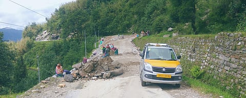
The strategically important Himalayan state is now connected to the rest of India through National Highway 10 which is prone to landslides during monsoon.
The planned highway will originate from National Highway 31C near Bagrakote in Jalpaiguri district and slither through Algarah and Lava in Kalimpong district of West Bengal to Rishi on West Bengal-Sikkim
border and move through Rhenock, Rorathang, Pakyong (location of Sikkim airport) and Ranipool before terminating at Gangtok.
Sources at NHIDCL said that though the project was sanctioned in 2015, surveys have been hastened since the Doklam crisis and work will begin this year.
“The highway was a long pending demand of the people of Sikkim. It is expected to provide a better alternative to NH 10 by being less vulnerable to landslides as the part of the Himalayas through which
the new highway will pass is densely forested and we know that trees hold soil together and prevent landslides to a certain extent. Also, this highway is expected to cut down travel time to Siliguri,” an NHIDCL official said.
Ground reports by The New Indian Express during the stand-off last year showed that the Chicken’s neck corridor in Siliguri was well within the range of the Chinese missiles during the crisis. Given the strategic importance of the Chicken’s neck corridor as the sole connection of Northeast with the Indian mainland
means that movement of Indian military deterrents against possible Chinese aggression would need better upkeep of the Himalayan roads that are prone to landslides.
