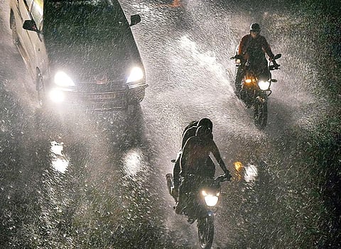

BENGALURU: Climatologists and climate change experts have warned that the number of thunderstorms, thundershowers and incandescent rainfall during the pre-monsoon period will intensify in the years to come.
Assessment of weather models prepared by researchers and experts from IISc and Empri has thrown up a changing pattern. India Meteorological Department (IMD) officials state that thundershowers are increasing during the pre-monsoon season, and admit to a rise in severity over the years.
This has also prompted IMD officials and researchers to count the number of thunderstorms that have occurred on a daily basis during the past few years, and not just assess rain damage. According to the IMD, in March 2022, Bengaluru experienced five thunderstorm days, the number went up to seven in April, and to nine in May so far.
A senior IMD official said: "The formation of cyclones in the Arabian Sea and Bay of Bengal is also on the rise. But for areas to get more rainfall, low pressure areas are required and not cyclones, which are associated with wind, and when intense, they cause more damage. Over the years, the number of cyclones is also increasing."
Another IMD official said the intensity of thunderstorms has increased in North Karnataka, which would earlier experience moderate rainfall. Hubballi and Belagavi are experiencing thundershowers which are common in coastal areas, or those that hit Bengaluru.
Retired IISc professor NH Ravindranath said climate change has brought a change in rainfall pattern. Projections by Empri have shown that high-intensity rainfall will increase in the years to come. A report on this was submitted to the central and state governments for action, but nothing has been done.
There is an urgent need for a good disaster management plan, which is still on paper, he said.
Indu K Murthy, principal research scientist, Centre for Study of Science, Technology and Policy (C-Step), said global and national models show that districts in interior Karnataka will experience rainfall, and last year's heavy flooding should serve as an alarm bell. She warned that if emission levels are not controlled, rain-related damage and thunderstorms will continue.
Prof G Bala, Professor, Centre for Atmospheric and Oceanic Sciences, Divecha Centre for Climate Change, IISc, said it is typical for the southern peninsula to experience heavy pre-monsoon showers, especially along the eastern side of the Eastern Ghats.
Such showers usually don't occur along coastal Karnataka, but over the years, these areas are also experiencing heavy rainfall. Prof Bala pointed out that even as pre-monsoon showers are becoming common and temperatures are rising, the frequency and intensity of rainfall is increasing, and needs to be watched.
Dull and rainy day ahead
BENGALURU: Cyclone Asani will bring rainfall coupled with thundershowers over most parts of south interior Karnataka for the next 24 hours, the India Meteorological Department (IMD) has forecast. The weatherman has asked people to be cautious and alert. BBMP and BESCOMm officials are also on alert to ensure there are no untoward incidents.
IMD-Bengaluru Director-in-charge Geeta Agnihotri said that Asani's movement will impact Karnataka’s fringes. Heavy rainfall over most parts of south interior Karnataka, with strong winds blowing at the speed of 30-40 kmph, have been forecast for the next 24 hours.
The chilly weather and cloudy skies have left citizens delighted, though those residing in low-lying areas are worried that rainwater could gush into their homes.