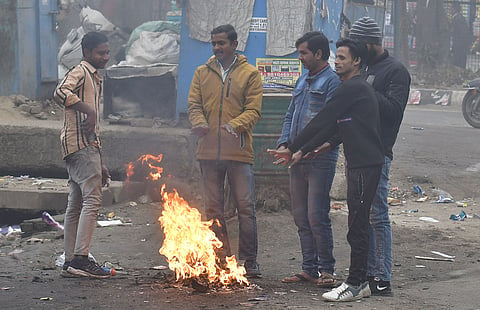

NEW DELHI: After extreme summer heat and above-normal southwest monsoonal rainfall, get ready for a severe winter and longer spell of cold wave this winter. The India Meteorological Department has predicted a higher possibility of drop in minimum temperatures in November-December due to the emergence of La Nina phenomenon.
Typically occurring towards the end of the monsoon season, La Nina, the cooler counterpart to El Nino, is characterised by lower sea surface temperatures in the equatorial Pacific sea, bringing a sharp drop in temperatures, often coupled with increased rainfall, raising concerns about the possibility of an extreme winter ahead. However, La Nina prediction during monsoon proved wrong.
The IMD also predicted above-normal average rainfall over south peninsular India, many areas of central India and northeast India during the post-monsoon season (October-December). The average rainfall is most likely to be above normal i.e. more than 112% of Long Period Average.
However, most parts of northwest, some parts of northeast and southernmost parts of India are likely to receive below-normal rainfall. In October, most parts of India are likely to receive normal to above normal rainfall except some parts of northeast and northwest India and a few pockets in the south peninsula.
The IMD underlines the reasons as continuation of favourable climatic conditions, such as existing neutral El Nino-Southern Oscillation (ENSO) conditions, neutral Indian Ocean Dipole (IOD) conditions and above-average sea surface temperatures prevailing over the Indian Ocean.
The IMD has also predicted above-normal maximum temperatures over most parts of the country except some parts from central India and above-normal minimum temperatures over most parts.
Analysing the southwest monsoon (SWM), the IMD said the monsoon was above normal despite absence of La Nina conditions. The country has received 934.8 mm rainfall against 868.6 mm -- around 8% above normal. The deficient rainfall was recorded only in three sub-divisions encompassing 11% of the country’s geographic area.
This year the southwest monsoon (SWM) set in over Kerala on May 30 against the normal date of June 1 and covered the entire country on July 2, against the normal date of July 8. Moreover, the SWM had withdrawn from some parts of west Rajasthan and Kachchh on September 23 against the normal date of September 17.
However, another peculiar feature of this year’s SWM was that it was quite weaker in Indo-Gangetic plains while excess in arid regions like Gujarat and western Rajasthan.
“In September, there were record three low pressure systems and three depressions which moved towards central and western India instead of Northwest like Uttarakhand and Himachal Pradesh and caused excess rainfall,” said Mrutyunjay Mohapatra, Director General, Meteorology. Further, monsoon trough mostly lied along normal to south of the normal position, which remained active.
Different regions are expected to experience varying degrees of winter severity. IMD says northern states like Himachal Pradesh, Uttarakhand and J&K may see frigid conditions. Additionally, the combination of colder weather could impact agriculture.