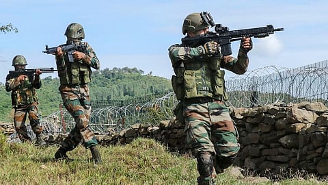
NEW DELHI: A ceasefire violation has been reported along the Line of Control (LoC) in the Poonch region of Jammu and Kashmir, with reports of unprovoked firing and an incursion by the Pakistan Army.
Army Public Relations Officer Lieutenant Colonel Suneel Bartwal said on Wednesday that the Indian Army “responded effectively in a controlled and calibrated manner.”
"On April 1, a mine blast occurred in the Krishna Ghati sector due to a Pakistan Army intrusion across the Line of Control.
This was followed by unprovoked firing and a ceasefire violation by the Pakistan Army," Bartwal said.
Another source reported a casualty on the Pakistan side, but there have been no casualties reported on the Indian side.
Colonel Bartwal also emphasised that the Indian Army has reiterated the importance of upholding the principles of the understanding between the two countries' Directors General of Military Operations (DGMO), to maintain peace along the Line of Control.
The situation has changed significantly since February 2021, when the DGMOs of India and Pakistan reiterated their commitment to the 2003 ceasefire agreement, ensuring peace along the de facto border.
India shares a total of 3,323 km of border with Pakistan, divided into three parts: the International Border (IB), approximately 2,400 km from Gujarat to the northern banks of the Chenab River in Akhnoor, Jammu; the Line of Control (LoC), 740 km long, running from parts of Jammu to parts of Leh; and the Actual Ground Position Line (AGPL), 110 km long, dividing the Siachen region from NJ 9842 to Indira Col in the north.