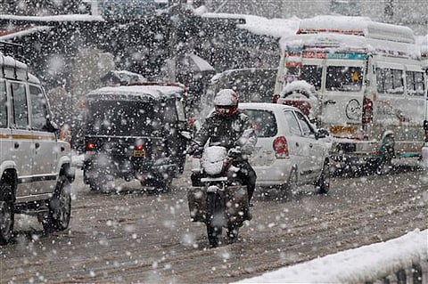
A fresh spell of back-to-back western disturbances is set to bring heavy snowfall and rainfall to the western Himalayas and Northwest India over the next few days. Additionally, a patch of very dense fog will persist across the entire Indo-Gangetic Plain. Meanwhile, Srinagar recorded a bone-chilling -8.5°C—the lowest temperature in 30 years.
The Indian Meteorological Department (IMD) has predicted that a series of western disturbances this week will result in heavy snowfall and rainfall in Northwest India. IMD forecasts significant snowfall in Jammu and Kashmir, Himachal Pradesh, and Uttarakhand over the coming days.
IMD has warned of “temporary disruption of surface and air transportation and higher chances of landslides and shooting stones over vulnerable places.” It has also advised tourists to “take precautions and plan accordingly.”
The first round of western disturbances is expected to impact the higher reaches of the western Himalayas late on the night of 4 January. According to IMD, heavy snowfall is forecast in Jammu and Kashmir, Himachal Pradesh, and Uttarakhand between 4 and 6 January.
This disturbance will also lead to isolated rainfall accompanied by thunderstorm activity over Punjab, Haryana, and Chandigarh on 5–6 January, and northwest Uttar Pradesh on 6 January. Scattered rainfall or snowfall is predicted in Uttarakhand on 6 January. In the northeastern states, light to moderate rainfall is likely on 7–8 January.
During the western disturbance spell, minimum temperatures are expected to rise by 3–4°C, before dropping sharply afterwards.
IMD has also issued a “cold day condition warning” for parts of Himachal Pradesh on 6–7 January, isolated pockets of West Uttar Pradesh on 4 January, and Bihar on 4–5 January. The IMD has further stated that “cold wave conditions are likely in isolated pockets of Telangana on 4 January.”
Meanwhile, dense fog is predicted to envelop the entire Indo-Gangetic Plain until 6 January, after which it is expected to clear. The fog may affect airports, highways, and railway routes during this period.
A second round of western disturbances is forecast to reach Northwest India on 10 January, bringing light to moderate rainfall and snowfall to the western Himalayas and parts of Northwest India.