GUWAHATI: The construction of a 'permanent' river embankment by Bangladesh at zero point along the border with India has set alarm bells ringing in Tripura.
The construction is taking place between Bangladesh’s Moulvibazar and Tripura’s Unakoti districts.
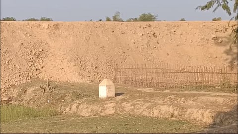
River Manu flows between the districts and it is feared that the situation in Unakoti might be devastating during the next flood.
Officials in Tripura said Bangladesh did not inform India before getting ahead with the work.
The construction is being seen as a one against the spirit of the Indo-Bangla Treaty of Friendship, Cooperation and Peace which does not allow any permanent construction on 150 yards from the zero point.
Accompanied by senior officials, Unakoti District Magistrate Dilip Kumar Chakma inspected the site on Friday.
“They (Bangladesh) are building an embankment for protection from floods. We visited the border area to take stock of it. We thought they have substantially raised the height of their old embankment,” Chakma told media.
“We will be required to strengthen our existing embankment as water will flow towards us more now. The matter has to be dealt with at a higher level,” he further stated.
According to the DM, the Indian embankment is located around 350 yards from the zero point.
“We have no idea about the length of the embankment, roughly around 1 km of it is visible. Work is still in progress. We learnt that they are preparing to make it pucca. I feel India should take necessary steps,” he added.
It was learnt that the state government would take up the matter with the Centre after receiving a report from the DM.
The matter was first brought to the notice of the state government by local Congress legislator Birajit Sinha.
"I noticed the construction during a recent visit to the border and brought it to the government’s attention in the Assembly. The government had no idea. I insisted on immediate measures. The Chief Minister said necessary steps would be taken in consultations with the central government," Sinha told TNIE on Saturday.
"Bangladesh raised the embankment’s height to a great extent, the floods would leave a trail of devastation in Unakoti, particularly the Kailasahar town," he added.
“Our embankment has a low elevation. It is very old and weakened. It requires repairs urgently. Last year, the water of River Manu entered the Kailasahar town through a rusty sluice gate and wreaked havoc,” Sinha also said.
BSF said an old elevated kutcha track, which exists in Bangladesh, is used by pedestrians, cycles and auto-rickshaws to go from one village to another in Bangladesh.
"During monsoon season, the top kutcha portion of the bund got damaged resulting in a number of potholes which Bangladesh tried to repair by putting fresh earth in November. As some portion of the elevated kutcha track falls within 150 yards of the international boundary, it was immediately observed by BSF and on November 8, 2024, a casual contact was made with BGB and a strong protest was lodged to stop the work immediately. Thereafter, the work was stopped by Bangladesh," the BSF said in a statement.
Stating that river Manu is approximately 700 meters away from the elevated road, the statement said the DIG of BSF, Panisagar apprised the DM of Unakoti about the actual ground realities.
"BSF is fully committed to maintaining the sanctity of the international border and will not allow any violation of the established ground rules," the statement added.
