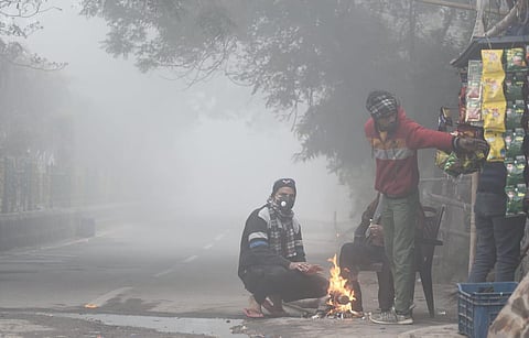
NEW DELHI: A fresh Western Disturbance is set to affect the Western Himalayan region this week, bringing snowfall to higher reaches and rainfall to lower areas, marking the onset of winter in North and Central India. Following this, the temperatures are expected to drop by 3 to 4 degrees Celsius said the India Meteorological Department (IMD). This may offer temporary relief from pollution across Northwest India.
According to the IMD, thunderstorms with lightning and gusty winds of 40 to 50 km/h are likely over Jammu, Kashmir, Ladakh, and Gilgit-Baltistan from November 4 to 6. Rain and thunderstorms are also expected in Rajasthan on November 3 and 4, Himachal Pradesh on November 4 and 5, Uttarakhand on November 4, and Punjab on November 4 and 5.
Experts suggest that after the passage of the Western Disturbance, we will see the formal arrival of winter in the Northern, Central and Eastern plains. “Night temperatures are likely to fall from the second week of November due to radiational cooling (less cloud cover and water vapour), and advectional cooling (horizontal transfer of cold air),” said Debasish Jena, an agrometeorology researcher at GB Pant University of Agriculture and Technology.
Meanwhile, Haryana and Delhi may receive light to moderate rain on November 4 and 5, with shallow fog already observed at Safdarjung Airport.
Winters at hand
Temperatures in northern, central India to drop by 3-4°C
Thunderstorms, gusty winds predicted over J&K, Ladakh, from Nov 4 to Nov 6
Winters to start formally in the Northern, Central, and Eastern Plains post western disturbance
Night temperatures to drop from 2nd week of November in north, central & east India
Low-pressure areas over northeast Arabian Sea & east-central Bay of Bengal observed