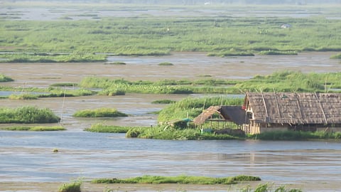
GUWAHATI: A study conducted by Nagaland University has sounded an environmental alert for the Loktak Lake, one of India’s iconic freshwater ecosystems and a designated Ramsar Site in Manipur.
Researchers found that changes in land use — particularly agriculture, settlements, and shifting cultivation — are directly deteriorating the water quality of rivers feeding into the lake, threatening its biodiversity and livelihoods of locals.
Loktak Lake is home to 132 plant species and 428 animal species, and supports hydropower, fisheries, transport, and tourism. However, in recent decades, the lake has been listed under the Montreux Record — a global warning list for wetlands undergoing serious ecological damage.
Reduced fish populations, rising pollution levels and increased sedimentation have now become growing concerns. A Ramsar Site is a wetland designated to be of international importance under Ramsar Convention on Wetlands. These sites are recognised for their ecological significance, such as supporting biodiversity or providing critical habitat for waterfowl.
The study was undertaken by Dr Eliza Khwairakpam, Assistant Professor, Department of Environmental Science, Nagaland University. The findings were published in the peer-reviewed ‘International Journal of Environment and Pollution.
’Highlighting the need for such studies, Prof Jagadish K Patnaik, Vice Chancellor, Nagaland University, said, “Nagaland University takes great pride in the significant research contribution made by our faculty (members) and scholars, revealing the strong link between land use and water pollution in the Loktak Lake catchment area of Manipur.”
The study highlights the pressing environmental challenges arising from agricultural runoff, human settlements, and shifting cultivation, which are directly impacting the river water quality in the region.
To understand the root cause, Nagaland University researchers conducted field sampling across nine major rivers — Khuga, Western, Nambul, Imphal, Kongba, Iril, Thoubal, Heirok and Sekmai — that drain into Loktak Lake.
Using detailed ‘Land Use Land Cover’ maps, Dr Khwairakpam compared different types of land activities such as agricultural areas, dense and degraded forests, settlements, Jhum cultivation and water bodies, against water quality indicators like dissolved oxygen, biological oxygen demand and temperature.
“Our study confirms that land use decisions across villages and forest landscapes upstream are directly impacting water quality downstream. This makes community-based land management and stricter control of agricultural runoff and waste discharge crucial for restoring Loktak Lake,” Dr Khwairakpam said.
