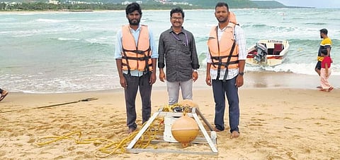

VISAKHAPATNAM: A rip current warning system has been installed at Rushikonda Beach in Visakhapatnam to develop techniques for automatically detecting the currents and explore the possibilities of sharing this information with lifeguards or beach managers.
According to the National Ocean Service, a rip current, also incorrectly called a rip tide, is a localised current that flows away from the shoreline toward the ocean, perpendicular or at an acute angle to the shoreline.It usually breaks up not far from shore and is generally not more than 25 meters (80 feet) wide.
Space Applications Centre (SAC-ISRO) in collaboration with Andhra University and the National Centre for Earth Science Studies (NCESS) has designed a rip current warning board explaining what rip
currents are, what to do if caught in them, and safety tips in a simple, multilingual format.
Additionally, the forecast that is received at the Beach from the Safe Beach website is accessed on site in real-time using an in-house developed module and internet service. This is converted into three types of warnings: low, moderate, and high.
“The warning system uses a traffic signal-like approach to alert beachgoers to the presence and strength of rip currents. Typically, the system uses a set of colour-coded lights to indicate the level of risk: green for low risk, yellow for moderate risk, and red for high risk,” explained CV Naidu, a professor at Andhra University’s Department of Meteorology and Oceanography.
“ISRO-funded SAMUDRA project at the Space Applications Centre is funding the activity. The main objective of the project is to develop techniques to automatically detect rip currents and explore the possibilities of sharing this information with lifeguards or beach managers. We are using state-of-the-art machine learning and artificial intelligence methods to automatically delineate the rips. This would be beneficial for the authorities to utilise lifeguard services more efficiently,” Dr SVV Arun Kumar, an ISRO scientist, stated.
While ISRO scientist Dr SVV Arun Kumar and department professor CV Naidu are acting as principal investigators, NCESS scientist M Ramesh is the co-investigator, along with AU research students B Girish and CH Venkateswarlu, group director Rashmi Sharma (Focal person SAMUDRA at SAC/ISRO), Group Director and Dr DR Rajak of Space Applications Centre and NCESS group head Dr Sheela Nair (Principal Investigator, SAMUDRA, NCESS) are providing technical support in the project.
As part of the research, a Video Beach Monitoring System (VBMS) was set up on the tower at Rushikonda Beach. This system consists of a camera installed on the top of a tower near the Rushikonda Beach.
Additionally, the Directional Wave and Tide Recorder (DWTR), which measures ocean waves and tides, and an eco-sounder, which measures ocean bathymetry, are being used to procure data.