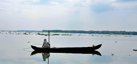

ALAPPUZHA: The Vembanad Wetland System, the second-largest Ramsar site of the country, is fraught with peril due to the accumulation of silt on the beds and illegal filling. The depth of the lake has diminished to an average of 3 metres from 9 metres over the past few decades that also saw a sharp fall in its fish wealth, says a study.
The floods of 2018 and 2019 aggravated the situation, and currently all areas, other than major boat routes and ship channels in Kochi, have lost their depths. The drastic fall in the depths may ultimately lead to the death of one of the largest ecosystems in the country, warns the four-year-long study by the Centre for Aquatic Resource Management and Conservation (CARMC) of the Kerala University of Fisheries and Ocean Studies (Kufos).
According to leader of the research team Dr V N Sanjeevan, the first phase of the study has been completed, and the findings are a cause of grave conern as they hint at a serious threat to the very existence of the wetland system. “The carrying capacity at Mean Sea Level (MSL) of the south and central sectors of the lake which covers from Kuttanad to Kochi Port area is reduced by 85.63% over the years. The capacity of the lake was 2677.50 million cubic metres (MCM) floodwater in 1930 reduced to 384.66 MCM in 2020,” he said.
The lake which had an area of 365 sqkm in 1900 has shrinked to 206.40 sqkm now. The south and central sectors of the lake had an average depth of 8-9 metres in 1930, which is now reduced to an average of 1.8 m in the south sector (Thanneermukkom to Kuttanad -78.82% depth loss) and to 2.87m for the central sector (Thanneermukkom-Kochi Port -66.34% loss). The rapid loss in depth of the lake is due to heavy siltation, as the sediment-laden waters directly reach the lake instead of flowing to the paddy fields, Sanjeevan said.
“Unscrupulous filling of the wetland also contributed in the lake losing its area. The fish wealth too registered a drastic fall. Around 150 to 200 fish species were identified in the lake in the 1950s and it has declined to below 100 now. Fish species like pearl spot, freshwater prawn, mullet, crab, catfish, anchovy, salmon, silver belly, sole fish, and shellfish in the lake are hit by the accumulation of silt in the bed. The natural process of accumulation of silt inside the paddy polder was stopped after the construction of strong outer bunds,” the report said.
“The 633 sqkm of paddy fields adjoining the rivers draining to the south and central sectors of the lake have a spillover retention capacity of 1270 MCM of floodwater which is sufficient to prevent flash floods. However, under the Kuttanad package scheme, the embankments of these paddy fields were strengthened with concrete or rouble dykes provided with only one or two narrow sluice gates to facilitate double paddy cultivation. With this, the pulsatile nature of these retention areas (receiving and storing floodwaters during high tides and allowing the settlement of most of the suspended sediment load and discharging the sediment-free waters to the lake during low tides) is almost lost. The paddy fields have rather become the storehouses of rainwater, with their potential to aggravate any flood situation,” the report said.
The report posits a set of recommendations for regaining the pulsatile nature of Kuttanad paddy fields. It calls for modification of the engineering design of sluice gates to permit free inflow and outflow of floodwater. These gates should have automated opening-closing devices. Discourage ‘virrippukrishi’ (farming beginning in April and harvesting by the September-October period) and encouraging fish or duck farming as an alternate source of income are other recommendations.
What’s a wetland?
What’s a Ramsar site?
How to regain the vibrancy of Kuttanad paddy fields?
Flora found in Vembanad Lake Scientific name (local name in brackets)