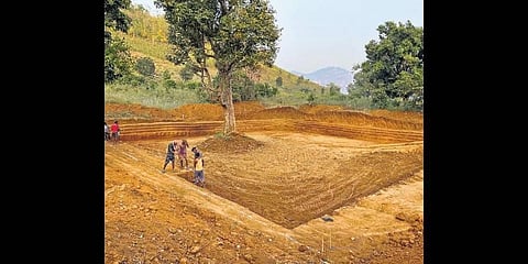

BHUBANESWAR: The State government, for the first time, is using a 3D scanning technology - light detection and ranging (LiDAR) - to implement soil and water conservation projects in forest areas.
The initiative is aimed at improving fodder and water in forests thereby reducing human-animal conflicts and increasing ground water recharge. The laser scanning technology is being piloted in Rayagada forest division to create soil and water conservation structures in the first phase, said Principal Chief Conservator of Forests (PCCF) and Head of Forest Force (HoFF) Sisir Kumar Ratho.
Contrary to empirical methods, LiDAR technology offers precise 3D measurement data for selection of sites to create these structures. The technology has an accuracy level of 95 per cent and above in recommending suitable sites.
The Forest department is implementing the project with the help of Water and Power Consultancy Services Limited (WAPCOS), a Central PSU under the aegis of Ministry of Jal Shakti, utilising CAMPA funds.
The WAPCOS in its DPR has recommended construction of 945 different structures for conservation of soil, soil moisture and water on 10,000 hectare area within the division. To make the process more scientific, six different parameters including soil moisture stress, land use pattern and rainfall data have been taken into account for selection of the structure sites. The PCCF said if implemented successfully in the division, the Forest department will replicate it in other areas of the State in future.
Apart from Odisha, WAPCOS has carried out LiDAR-based surveys of forest areas in 10 other states including Assam, Bihar, Chhattisgarh, Goa, Jharkhand, Madhya Pradesh and Maharashtra.