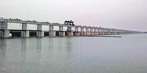

SAMBALPUR: A hydrographic survey is being conducted at Hirakud Dam reservoir to ascertain the profile of the Mahanadi river. The survey was launched after the Mahanadi River Dispute Tribunal asked Odisha government for the current profile of the river. The chief engineer of Upper Mahanadi Basin Ananda Chandra Sahu said the Tribunal has sought the survey report to know about the changes in the cross-section and longitudinal section of the river. Mumbai-based firm Siet Engineering Pvt Ltd has been entrusted with the survey work after tender process.
The survey is being conducted up and down the river including some parts of Chhattisgarh. The whole river system has been divided into several grids. Since the downstream of the dam has no water, the survey there is being conducted through drones. But due to presence of water on the upstream, the surveyors have to use boats and take readings through echo sounding method.
“We will also use bathymetric survey to estimate the sedimentation in the reservoir. The survey was started around a month back. We expect it to be over in next one and a half month,” Sahu said. Earlier in 2015, a survey was conducted by the National Institute of Hydrology, Kakinada to assess the sedimentation in the reservoir. Preliminary assessment revealed an estimated 17 per cent sedimentation in live storage. However, the final report of the survey is yet to be submitted.
Sahu said, “Basing on the data of the bathymetric survey, we will try to make a fresh assessment on sedimentation in the reservoir in order to the profile of Mahanadi river. The current data will be compared with the data of the reservoir in 1960.”