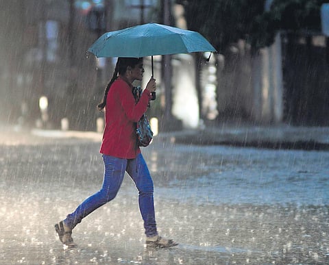
BHUBANESWAR: Stopping the staggering heat wave on its track, a nor’wester hit across 10 districts of the state, bringing relief to many parts of Odisha as mercury plunged after heavy thundershowers on Sunday.
Districts across the coastal, north and southern parts were lashed by heavy rains accompanied by gusty winds and lightning in the late afternoon hours. The met office said a trough running from interior Odisha to north Tamil Nadu across Chhattisgarh, Vidarbha, Marathwada and interior Karnataka led to the thundershower activities.
The good news is thundershower activities may continue for another 24 hours which will abate the hot and sweltering condition. The regional met office has forecast thunderstorm and lightning accompanied with gusty surface wind at one or two places in 12 districts on Monday.
“Rainfall activity will occur in the state due to the trough and moisture incursion from the Bay of Bengal,” said director of IMD, Odisha Dr Manorama Mohanty. As a result, light to moderate rainfall and thundershower activity is expected at many places till Thursday.
The nor’wester ensured the sizzling Bhubaneswar calmed down too. Though maximum day temperature was 37.2 degree C in Bhubaneswar, the night temperature fell sharply. The heavy rains affected normal life, impacted power supply and brought traffic to a complete halt for about an hour. Neighbouring Cuttack recorded 35.6 degree C on the day.
The nor’wester also brought down maximum day temperature across other parts of the state. Apart from Malkangiri (41.1 degree C), no other place touched the 40 degree C mark on the day as compared to 23 places on Saturday.
Many places recorded a drop in maximum temperature by 2 degree to 4 degree C. Though the mercury level is expected to rise by 2 degree C to 3 degree C across many places of the state after four days, day temperature is expected to remain normal during most parts the week. The met office predicted the day temperature will remain between 36 degree C and 38 degree C in the capital city till Saturday.
