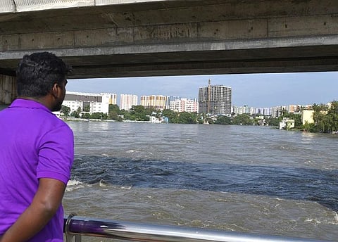
CHENNAI: The interim report of Thiruppugazh Committee report submitted in May 2022 had identified the biggest challenge as the lack of flood carrying capacity of Chennai's rivers and stormwater drains, and urged the government to implement its recommendations at the earliest.
The report, which was accessed by TNIE, also highlighted the issue of encroachments and recommended a ban on developments along the flood plains. Had the recommendations been implemented by the government over the last one year, the impact of the cyclone could have been reduced.
Details on the final report, which was submitted in May this year, and its long-term plans for water management in Chennai are yet to be made public. Chief Minister MK Stalin had requested the committee to give area-specific stormwater drain plans for the city and devise long-term plans for basin areas in Chennai, Kancheepuram, Tiruvallur, Chengalpattu and Ranipet.
The interim report has castigated Chennai Metropolitan Development Authority saying that there are provisions in the Town and Country Planning Act to reserve land in floodplains and hazard-prone areas to regulate construction. However, it is not reflected in the land use plans prepared by CMDA in the Second Master Plan as there was no flood hazard map for Chennai Metropolitan area, the report said.
The committee had recommended preparation of comprehensive hazard risk analysis for a better understanding of flood risk in Chennai Metropolitan area, to help risk-informed development and mitigation. The report also urged the Commissioner of Revenue Administration to prepare flood hazard maps for CMDA through Japan International Cooperation Agency (JICA). But this has not been implemented.
The report suggested that a detailed drainage master plan be prepared to identify drainage pathways of floodwater, even over patta land and government land. Further, land that might serve as flood plain or flood cushion should also be included in the drainage master plan. Such identified areas should be categorised under drainage areas and such patches and pathways should be declared as "No Development Zone" while granting planning approvals by the local bodies.
Similarly, the guidelines used by Town Panchayat and Village Panchayat for development approvals need a re-look to preserve waterbodies and waterways and to serve as a flood plain. The report suggested that allocation of lands for government projects should avoid the foreshore of waterbodies, flood plains and drainage lines. Wherever possible such incursions should be relocated to give way for water.
The report also said $251 million Asian Development Bank loan for climate-resilient, integrated urban flood protection and management in Chennai-Kosasthalaiyar river basin to strengthen resilience of Chennai city to floods do not address inundation along the Cholavaram, Redhills and Madhavaram surplus courses which is a major concern in highly dense residential area which also is a highly sensitive and vulnerable industrial zone.
There was an SoS from Manali industrial area during 2021 north east monsoon as operations came to a grinding halt. Being a highly sensitive industrial area, any inefficiency in the drainage design and disposal of excess runoff or riverine floods from the Redhill surplus course will pose a significant threat to the environment, the report added.
As per the Chennai City River Conservation Project (CCRCP) which was implemented during 1999 to 2005 for mitigating floods, since the areas below the right flank weir of Madhavaram tank was completely urbanised, the combined run-off from Madhavaram watershed comprising group of tanks from Paruthipatu tank about 5,000 cusecs of water as per Mott McDonald report was proposed to be diverted to Redhills tank surplus canal through the newly constructed weir at the left flank end of Madhavaram tank, for which the canal must be formed. However, till date for want of acquisition of lands that is pending since 1999, the year in which the original Government Order for the land acquisition was issued. This is the major cause for flooding in Madhavaram, Tondiarpet, part of Thiru Vi Ka Nagar and Ambattur, the report said.
As regards Kovalam basin, the committee suggested that a detailed feasibility study be carried out by Greater Chennai Corporation in coordination with the Water Resources Department in establishing automated pumping stations in low-lying sites for implementation at the earliest, after due vetting by a technical committee. "Instead of a few large, automated pumping stations, the design should include several small pumping stations distributed across low-lying isolated watersheds of Kovalam basin draining into Pallikaranai marshland and south Buckingham canal for achieving the desired level of flood reduction," the report stated.
Currently, GCC is implementing a stormwater drain project along 688 roads at an estimated cost of `508.33 crore in the city with funding from German Bank KfW. The report said efforts must also be immediately taken by the GCC and Water Resources Department to establish canals for the missing links in the surplus canals of tanks in Madurapakkam odai 2, Otyambakkam, Arasankazhani and Perumbakkam watersheds in GCC and Chengalpattu districts to reduce flood risk in southern Chennai metropolitan area with more vertical expansion.
The missing links for discharging the run-off from the integrated stormwater drainage network into waterbodies and macro drains should also be established through lands owned by private individuals and re-designate such water pathways as a no-development zone and freeze any future development through appropriate techno-legal framework.
The report also hit out at Mambalam canal front development under the smart city project. "The idea of public space creation such as walkways and cycle tracks should not overshadow the eco-purpose of the macro drain. However, the committee feels that in the case of the Mambalam canal, in an effort to create public space, the sound ecosystem functions have been compromised. The project should be re-conceived and redesigned based on strong ecological principles, without compromising on flood-carrying capacity of the canal and at the same time providing a reasonable public space wherever possible.
The connectivity of all lateral stormwater drains along the entire stretch of the Mambalam canal, Reddykuppam canal and Nandanam canal should be ensured before the next monsoon. All missing links within the stormwater drain system should be identified and linked, the report said.
The Mambalam canal originates from metrowater station near Valluvar Kottam and passes through T Nagar, Nandanam and finally confluence with the Adyar passing through a distance of 5.77 km. It was also learnt that the state has proposed widening of the Adyar below Thiruneermalai up to Anakaputhur bridge for a length of 1,800 metre. It was found during a survey that the width of the river is only 15 metres to 40m which is inadequate to carry flood discharge up to 19,000 cusecs. Hence, there is a need to increase the width upto 120m, so that the inundation in Varadharajapuram, Mudichur and Thirumudivakkam area can be reduced.
The report has suggested that guidelines used by town panchayat and village panchayat for development approvals need a re-look to preserve waterbodies and waterways and to serve as a flood plain or flood cushion. It said the government should consider acquiring patta land that are perennially flooded and re-designate the land as a buffer for flood mitigation.
The report also said a lot of causeways are washed away across Kosasthalaiyar during floods, in its Nagariyar arm and below Poondi reservoir as well as in the Palar. The main cause of the damage to the causeways is degradation of riverbed due to legal or illegal sand mining. The bed has been degraded to 2 meters below bed level due to which the existing cut off wall of all the causeways are being washed away. All the damaged low-level causeways across Chennai rivers and waterways should be reconstructed and sand mining activities that may destabilize due to scouring of bridge section must not be allowed.
