ERODE: As farmers continue to seek permission to take silt from the Kunderipallam Dam in Erode district, the revenue department began a digital survey in the dam's water-spread area on Saturday. The purpose of the survey is to identify revenue and forest department lands separately.
Kunderipallam Dam is located on the foothills of Gundri in Gobichettipalayam taluk of Erode district. The 41.75-foot-high dam serves the drinking and irrigation needs of the area.
With the decline in the water level in the summer, farmers in Gobichettipalayam have been seeking permission to take silt from the dam. On Saturday, the water level was 25.77 ft.
Farmers had also requested Tiruppur MP K Subbarayan to take action in this regard. Subbarayan conducted an inspection at the Kunderipallam Dam on Saturday morning and instructed the officials to take steps on farmers' demands.
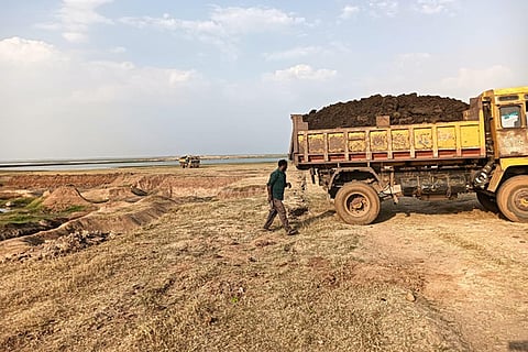
S Mohankumar, District Secretary of CPI, said, "In Kunderipallam, the water level in the dam has decreased now, exposing the bed and the accumulated silt. Silt plays an important role in enriching agricultural lands. Farmers have been demanding the nod to take silt from the catchment area of the dam so that they can use it in their agricultural lands. But officials keep delaying it."
"Taking silt from a dam can increase the amount of water stored in the dam. Farmers presented this demand to the MP. Subsequently, he inspected the dam," he added.
The dam's full capacity is 108.21 million cubic feet (mcft), but on Saturday it was just 37.43 mcft.
Regarding the survey, Gobichettipalayam Sub-Collector S Sivanandam, told TNIE, "There is some complication in identifying revenue and forest department lands separately in the dam's water-spread area. Due to this, the revenue department has started a digital survey to identify the lands on Saturday. This task will be completed in two days."
"Subsequently, the level of silt accumulated on revenue department lands will be calculated in collaboration with WRD officials. After that, a report containing details including farmers' requests and the level of silt will be sent to the district collector. Then the district collector will decide on allowing farmers to take silt," he added.
