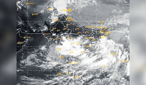
CHENNAI: Tamil Nadu is heading into an unusually active northeast monsoon phase as a low-pressure area has formed over the Southwest Bay of Bengal off the Sri Lankan coast.
The system, already showing a tight cloud wrap, is expected to move west-northwestward and trigger widespread rainfall from November 16 to 18.
The delta districts will be the first to come under heavy to very heavy rainfall on November 16, followed by Chennai and surrounding districts on November 17 and 18, according to the Regional Meteorological Centre (RMC), Chennai.
What makes this spell noteworthy is that it is happening without support from the Madden–Julian Oscillation (MJO), a major atmospheric driver that usually boosts monsoon systems. The MJO is a large pulse of rain and clouds that travels eastward around the globe every 30–60 days. When it is positioned over the Indian Ocean, it energises monsoon systems. But at present, the MJO is stuck over the Pacific Ocean and not in a favourable phase for India.
Despite this, the monsoon is strengthening due to another powerful atmospheric feature called the Equatorial Rossby (ER) Wave.
The ER Wave is a slow-moving tropical wave near the equator that can trigger or enhance low-pressure systems by increasing moisture and convergence.
IMD’s extended range outlook shows the ER wave currently moving across the Arabian Sea and Bay of Bengal, creating highly favourable conditions for rainfall and even another potential system, possibly a cyclone later, as per weather experts.
IMD notes that the ER wave, combined with strong wind anomalies over the south and central Bay, is setting the stage for a rare, MJO-independent active monsoon phase that may continue into next week.
