CHENNAI: The low pressure area (LPA) expected to form over the southeast Bay of Bengal around November 22 (Saturday) is likely to intensify into a depression, potentially setting the stage for another wet spell across the state.
The Regional Meteorological Centre (RMC), Chennai, said the LPA is “very likely to move west-northwestwards and intensify into a depression over the central parts of south Bay of Bengal around November 24,” before strengthening further over the southwest Bay during the subsequent 48 hours, said P Senthamarai Kannan, director, Area Cyclone Warning Centre.
While this indicates a clear intensification trend, IMD has not yet stated whether the system may become a cyclonic storm. However, several numerical models are hinting at a possibility. Skymet vice-president Mahesh Palawat said early model guidance shows a 60% probability of the system turning into a cyclone once the depression stage is reached, with current tracks favouring the north Tamil Nadu-south Andhra coast.
Weather blogger K Srikanth noted a significant divergence among global models, pointing to multiple embedded vortices that complicate early predictions. He said models will begin converging only after the LPA forms on November 22.
Ahead of the system’s intensification, the IMD has issued heavy rainfall warnings for several districts throughout the week. On November 20, the alerts are for Cuddalore and Mayiladuthurai. On November 21, heavy rain is expected in Kanniyakumari, Tirunelveli, Thoothukudi, Ramanathapuram, Nagapattinam, Mayiladuthurai, Cuddalore and Karaikal.
Apart from these districts, on November 22 and 23, widespread alerts are also in place for Thanjavur, Tiruvarur, Pudukkottai, and Sivaganga. Similar warnings continue on November 24, with the same districts likely to receive heavy rain.
By November 25, Pudukkottai, Thanjavur, Tiruvarur, Nagapattinam, Mayiladuthurai, Cuddalore, Villupuram, Karaikal and Puducherry are under heavy rainfall alerts.
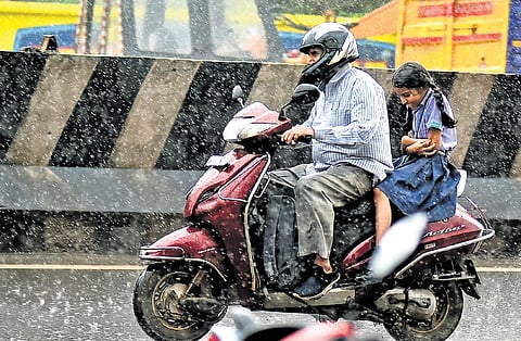
Chennai is expected to see light to moderate rain with thunderstorms over the next two days, with maximum temperatures around 31-320C and minimum temperatures around 24-250C. In the last 24 hours ending 8.30am on Wednesday, Oothu station in Tirunelveli received the highest rainfall of 23cm. Several places in Tirunelveli, Tenkasi, Thoothukudi, and Mayiladuthurai also received heavy rainfall.
