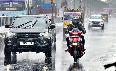
CHENNAI: A new low-pressure area has formed over the Southeast of the Bay of Bengal and adjoining the South Andaman Sea early Friday, triggering a fresh spell of northeast monsoon rains in the North coastal region of Tamil Nadu, including Chennai.
The Met Office said the system, which developed under the influence of an upper air cyclonic circulation, is likely to move in west-northwest direction and would become more marked in the next 24 hours.
An orange alert has been issued for Chennai, Kancheepuram, and Tiruvallur districts on October 27, warning of heavy rainfall accompanied by thunderstorms and lightning. Parts of Chengalpattu and Ranipet are also expected to receive intense showers during the said period.
According to the IMD’s five-day forecast, heavy rains are likely in Chennai and neighbouring districts till October 28 with possibilities of waterlogging in low-lying areas.
In the last 24 hours ending 8.30 am on Friday, widespread rainfall were reported across several districts, with Pallipattu in Tiruvallur recording the highest at 15 cm, followed by Nalumukku in Tirunelveli (12 cm) and Oothu (11 cm). Arakonam in Ranipet district recorded 10 cm, while Medavakkam in Chennai received 9 cm.
Several parts of southern Tamil Nadu, including Kanyakumari and Tirunelveli, also witnessed moderate to heavy spells.
Chennai Corporation officials said field teams have been placed on alert to clear stormwater drains and ensure swift water discharge ahead of the rains this weekend.
Fishermen have been advised not to venture into the sea as strong winds are likely to prevail along the Tamil Nadu and south Andhra coast in the coming days.
With the northeast monsoon active, IMD officials cautioned that intense rainfall episodes may continue over the next week, particularly in northern coastal districts.
