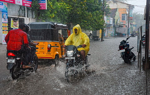

CHENNAI: The developing cyclonic system 'Montha' over the southeast Bay of Bengal is heading steadily towards the Andhra Pradesh coast, with early forecasts suggesting that north Tamil Nadu, including Chennai, may escape major impact.
The India Meteorological Department (IMD) said the depression, which formed over the southeast Bay of Bengal, is expected to intensify into a cyclonic storm by October 27 and further into a severe cyclonic storm by October 28, before crossing the coast between Machilipatnam and Kalingapatnam, near Kakinada, with wind speeds of 90–100 kmph, gusting to 110 kmph.
Weather models indicate two possible scenarios for Tamil Nadu’s rainfall prospects. One, the system moves away towards Andhra directly from the open seas without nearing the north Tamil Nadu coast, the Kancheepuram–Tiruvallur–Chengalpattu–Chennai (KTCC) region will receive only light to moderate rainfall, missing out on the heavy rain bands.
Another possibility is the cyclone edges closer to the north Tamil Nadu coast before curving away, Chennai and its neighbouring districts could see one spell of heavy to very heavy rain as the system’s outer rain bands brush past the shoreline.
“We will have a clearer picture by Sunday,” said weather blogger Pradeep John.
The October 27 and 28 are being marked as critical days to watch for any heavy rainfall or strong wind activity. The IMD has advised fishermen along the north Tamil Nadu and Andhra coasts not to venture into the sea from October 25 to 28, as conditions are expected to be rough to very rough.
After the system moves inland, Tamil Nadu is likely to enter a brief dry spell in the first week of November, before the next low-pressure system forms in the Bay.
In the last 24 hours ending 8.30 am on Saturday, Oothu in Tirunelveli received the highest rainfall of 14 cm followed by Nalumukku 13 cm and Kakkachi 11 cm, also in Tirunelveli.