HYDERABAD: The city saw a monsoon-like day on Thursday, with hours of intense rain and thunderstorms from late afternoon.
While bringing relief from the summer heat, the rains led to traffic congestion, power cuts and flooded roads. Thunderstorms began in the early afternoon, followed by citywide rain, which intensified in the evening as commuters rushed home, worsening traffic.
Thunderstorms disrupted power supply, causing outages in several areas, including Rajendranagar, Attapur, Sun City, Hydershahkote, Masab Tank, Begumpet, Nagole and parts of the Old City.
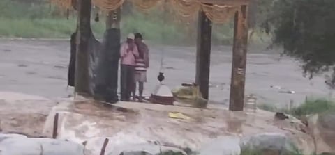
Two persons were stuck in the Musi river at Chaitanyapuri as water levels suddenly rose due to the rains.
Traffic movement hit hardest by rain
Heavy rain reduced visibility, forcing commuters to take shelter under flyovers and in shops. The waterlogged roads added to their woes.
Many areas, including Nanal Nagar, Attapur, Rethi Bowli, Tolichowki, Shaikpet, Raidurgam, Hitec City corridor, Kondapur, Banjara Hills, Jubilee Hills, KBR Park, Raj Bhavan, Begumpet, Punjagutta, Somajiguda, Khairatabad, Masab Tank, Lakdikapul, Ravindra Bharathi, Nampally, Koti, Abids, Greenlands, Langar Houz, Golconda, the Old City, Secunderabad and Uppal, reported waterlogging and heavy traffic on arterial roads and flyovers.
Traffic congestion slowed movement, turning 30-minute commutes into over an hour, leaving commuters frustrated and exhausted. J Ravi, a commuter, said it took him 1.5 hours to travel from Shaikpet to Raj Bhavan Road due to the traffic jam.
Many struggled to find cabs and autorickshaws, as aggregators refused bookings due to traffic and rain. A commuter, Swathi V, said she waited nearly an hour for a cab and finally got one after adding a substantial tip. Even then, she took 1.5 hours to reach her office due to bad weather and traffic.
HYDRAA received 48 stagnation and 29 blocked catch-pit complaints across the city.

According to TGDPS, the state’s highest rainfall was 106.8 mm in Yadadri Bhuvanagiri district, followed by 96 mm in Himayatnagar, Hyderabad.
IMD reported an upper-air cyclonic circulation over Marathwada and adjoining Maharashtra at 0.9 km above mean sea level, with a trough running from South Interior Karnataka to southwest Madhya Pradesh across this system.
Another cyclonic circulation lies over north coastal Andhra Pradesh and adjoining south Odisha at the same altitude. Due to these systems, the state will continue to experience heavy rain and thunderstorms. Moderate rainfall was also recorded in Bhadradri Kothagudem, Mahbubabad, Medchal-Malkajgiri and Rangareddy districts. Maximum temperatures will drop by 2°C–3°C over the next three days.
IMD issued a yellow warning for thunderstorms with lightning and gusty winds (30–40 kmph) in Adilabad, Kumurumbheem Asifabad, Nirmal, Nizamabad, Nalgonda, Suryapet, Warangal, Hanamkonda, Siddipet, Yadadri Bhuvanagiri, Rangareddy, Hyderabad, Medchal-Malkajgiri, Vikarabad, Jangaon, Mahbubnagar, Nagarkurnool, Wanaparthy, Narayanpet and Jogulamba Gadwal.
Over the next 48 hours, Hyderabad will see light to moderate rain or thunderstorms with gusty winds (30–40 kmph).
Maximum and minimum temperatures will be around 34°C and 24°C, respectively. Surface winds will be south-westerly at 4–6 kmph.
5 injured as wall collapses on auto
Hyderabad: Five persons sustained grievous injuries after a wall in an under-construction complex collapsed on an auto-rickshaw passing by, in Saroornagar police station limits on Thursday. The clip of the incident was circulated widely on social media. A passerby is seen crossing the stretch just seconds before the mishap occurred. The injured persons have been shifted to a hospital for treatment.