NEW DELHI: The western Himalayan region logged an 80 per cent precipitation deficit in December, and January so far has been almost dry, with the India Meteorological Department attributing it to the lack of active western disturbances this winter season.
The absence of active western disturbances - weather systems that originate in the Mediterranean region and bring unseasonal rainfall to northwest India - is also the reason behind the blinding layer of fog persisting over the plains in the region since December 25, the IMD said on Thursday.
The precipitation deficit is likely to impact freshwater availability in the Himalayan region, further affecting horticulture and agricultural production, said Sonam Lotus, the head of the meteorological centre in Leh in Ladakh.
"January is peak winter but surprisingly, it is so warm in Ladakh and Kashmir that crops are blooming early, and this is very worrying," he said.
Raihana Habib Kanth, Dean (Agriculture) Sher-e-Kashmir University of Agricultural Sciences and Technology of Kashmir, said the snowfall in the Chillai Kalan period (December 21 to January 29) is the only freshwater source for the region before the southwest monsoon sets in.
"The prolonged dry spell has reduced the water level in the rivers and streams in the region," she said.
According to a report authored by IMD scientists Krishna Mishra, Naresh Kumar, and RK Jenamani, maximum temperatures have been below normal by 5-8 degrees Celsius over the northern plains since December 29, with a respite on January 7-8 due to a western disturbance.
Minimum temperatures have been below 4 degrees Celsius at many stations in the region from January 12 to 17.
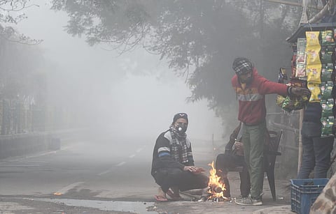
Also, very dense fog has been persisting over the plains of northwest India since December 25, reaching its maximum intensity and duration on January 14 when visibility dropped to zero metres over the entire northern plains from Amritsar to Dibrugarh across Haryana, Delhi, Uttar Pradesh, and Bihar.
This severe weather over north India is primarily due to the lack of active western disturbances over northwest India during December and January.
Generally, 5-7 wester disturbances impact the region during these months.
The region has not seen any strong western disturbance this winter so far, the scientists said.
Two western disturbances affected the country, one in December and another in January, but their impact remained confined to Gujarat, north Maharashtra, east Rajasthan, and Madhya Pradesh, they said.
"As a result, the western Himalayan Region has received very little precipitation (rain/snow) during the month of December, roughly about 80 per cent less than normal. Similarly, there has been almost nil precipitation in the region in January so far," the report read.
This severe weather is mainly due to three reasons: lack of active western disturbances over northwest India, prevailing El-Nino conditions, and a strong jet stream, the scientists said.
Kumar said: "Fog formation requires three conditions: weak low-level winds, moisture, and overnight cooling. Strong western disturbances, characterized by strong winds and precipitation, disrupt these conditions."
Strong jet streams -which are bands of strong wind that generally blow from west to east all across the globe and impact weather - have been prevailing over north India for the last five days.
It is leading to subsidence of cold air and enhancing cold wave/cold day conditions over the region.
These conditions are likely to continue over the next five days, he said.
The lack of active western disturbances can also be attributed to the prevailing El-Nino conditions, abnormal warming of surface waters in the central Pacific Ocean.
During El-Nino years, there are fewer cold wave days over north India during December and January.
