BHUBANESWAR: The India Meteorological Department on Sunday said cyclone ‘Montha’ is in the process of being formed and will dump most rains during Tuesday and Wednesday in the state.
Eight districts such as Ganjam, Gajapati, Kandhamal, Rayagada, Kalahandi, Nabarangpur, Koraput and Malkangiri are likely to receive heavy to very heavy rainfall caused by the system. Similarly, Puri, Jagatsinghpur, Kendrapara, Khurda, Cuttack, Nayagarh, Boudh, Balangir and Nuapada districts may witness heavy showers on Monday.
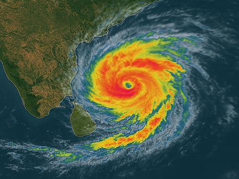
Currently, the system is in shape of a deep depression over southeast Bay of Bengal and moving west-northwestwards at a speed of 8 kmph and lay centered over south-east and adjoining southwest Bay of Bengal, about 900 km south-southeast of Gopalpur at 5.30 pm on Sunday.
It is likely to move nearly west-northwestwards and intensify into a cyclonic storm within the next 12 hours. Initially, tropical storm Montha may move northwestwards, then north-northwestwards and intensify into a severe cyclone by Tuesday morning.
Continuing its north-northwestward movement, it is likely to cross Andhra Pradesh coast between Machilipatnam and Kalingapatnam around Kakinada during Tuesday night as a severe cyclone with a maximum sustained wind speed of 90 kmph to 100 kmph and gusting up to 110 kmph.
From Tuesday onwards, the system will induce very heavy rainfall and wind speed reaching 60 kmph to 70 kmph in Gajapati, Ganjam, Rayagada, Malkangiri and Koraput districts. Similar weather condition is expected to prevail in Rayagada, Malkangiri, Koraput, Nabarangpur and Kalahandi districts on Wednesday.
Director of Bhubaneswar Meteorological Centre Manorama Mohanty said, “The storm will trigger widespread rains over the state in the next four days. However, its maximum impact will be on Tuesday and Wednesday.”
The regional met office said squally weather with wind speeds reaching 45 kmph to 55 kmph and gusting up to 65 kmph may prevail along and off south Odisha coast from Monday evening. Gale wind gusting up to 80 kmph is expected in the region between Tuesday evening and Wednesday morning.
Similarly, squally wind speed reaching 50 kmph to 60 kmph and gusting up to 70 kmph is likely along and off north Odisha coast from Tuesday evening to Wednesday morning. The regional met office advised the fishermen to not venture along and off Odisha coast till Wednesday.
