Earthquakes, tremors and landslides are not new to the North Indian topography, but their increasing frequency is alarming. The Joshimath tragedy of 2023 and the more recent tunnel collapse in Uttarakhand have raised ecological concerns in the mountain regions, especially the foothills of the Himalayas. Even the Everest base camp seems to be flooding with people, in recent times.
There are many popular hill stations, and pilgrim centres on the foothills, and the Ganges plains, that hold extreme significance to the people of India. But, these locations have become overcrowded, which is also raising environmental concerns. So is overpopulation the only concern? Not really! The Himalayas do not face only external problems from overcrowding. There is a more natural, internal change that takes place in this magnificent mountain range every year that could soon put a lot of these Indian hill stations ‘under the sheets’ of these mountain ranges.
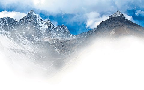
The Indian subcontinent, situated at the collision zone of two major tectonic plates -- the Indian Plate and the Eurasian Plate -- began around 50 million years ago, giving rise to the Himalayan mountain range through a process known as orogenesis. The Himalayas are young fold mountains, as they were formed only a few million years ago, and continue to rise every year, and the Indian subcontinent continues to move northwards, into Asia, which explains the frequent earthquakes and landslides in the region today.
The movement of tectonic plates in the Himalayan region is driven by the process of plate tectonics, wherein the Earth’s lithosphere is divided into several rigid plates that float on the semi-fluid asthenosphere beneath them. The Indian Plate, moving northward at a rate of about 5 cm a year, continues to converge with the Eurasian Plate, leading to compression, uplift, and folding of the Earth’s crust in the Himalayan region. This tectonic activity is responsible for the seismicity and mountain-building processes that characterise the Himalayas. In recent years, there has been growing concern over the rapid movement of the Himalayan tectonic plates and the potential risks it poses to the hill stations of North India and the plains across the River Ganga.

The movement of the Himalayan tectonic plates has significant implications for the geology, topography, and socioeconomic landscape of North India and the surrounding regions. One of the primary concerns in these areas is the increased risk of seismic activity, earthquakes and landslides. The collision between the Indian Plate and the Eurasian Plate generates immense tectonic stress along fault lines, accumulating strain and releasing energy in the form of earthquakes.
In addition to seismic hazards, the movement of tectonic plates can also impact the topography and hydrology of the region. The uplift of the Himalayas alters the flow patterns of rivers and streams, leading to changes in drainage patterns, erosion, and sedimentation. The rapid movement of tectonic plates can trigger geological processes such as faulting, fracturing, and uplift, which may destabilise the hills and increase the susceptibility of the region to landslides and soil erosion. Hill stations and urban settlements in the foothills of the Himalayas are particularly vulnerable to these hazards, as they are situated in areas prone to slope instability and geological instability.
The implications of the moments of Himalayan tectonic plates extend beyond the immediate vicinity of the mountain range, reverberating across the Indian subcontinent and beyond. The North Indian states of Uttarakhand, Himachal Pradesh, and Jammu and Kashmir, are directly affected by the geological processes associated with the Himalayan tectonic plates.
The hill stations situated here, nestled amidst the majestic peaks of the Himalayas, are popular tourist destinations known for their scenic beauty, cool climate, and cultural attractions. However, they are also prone to the hazards posed by the rapid movement of tectonic plates, including earthquakes, landslides, and flash floods.
The vulnerability of these hill stations is further exacerbated by factors such as unplanned urbanisation, deforestation, and inadequate infrastructure, which increase the risk of disaster and hamper the effectiveness of response and recovery efforts.
The plains across the Ganga, including the densely populated regions of Uttar Pradesh, Bihar, and West Bengal, are also vulnerable to the impacts of the tectonic movements. It can alter the flow patterns of rivers, leading to changes in sedimentation, and water availability, and increasing the risk of floods.
The Gangetic Delta is particularly susceptible to the impacts of sea-level rise, subsidence, and coastal erosion, intensified by the tectonic activity in the Himalayan region.
Mitigating risk to life
Early warning systems regarding earthquakes, landslides, and other geological hazards can help reduce the risk to human lives and infrastructure. These systems rely on realtime monitoring of seismic activity, geodetic measurements, and remote sensing data to provide timely alerts and actionable information to at-risk communities. Conducting comprehensive risk assessments and integrating hazard mapping into land-use planning can help identify areas prone to geological hazards and inform development decisions. This includes zoning regulations, building codes, and infrastructure standards that take into account the seismic vulnerability of the region.
Promoting regional cooperation and collaboration among countries sharing the Himalayan region can enhance the effectiveness of disaster risk reduction efforts and foster resilience across borders. This includes sharing data, expertise, and best practices, coordinating response and recovery efforts, and jointly addressing transboundary challenges such as water management and ecosystem conservation. By implementing these strategies, policymakers, scientists, and communities can work together to mitigate the risks posed by the rapid movement of the tectonic plates and build a more resilient future for subcontinent.
Nepal Earthquake
The Himalayan region is seismically active, with frequent occurrences of moderate-to-large earthquakes. The devastating earthquake that struck Nepal in 2015, resulting in thousands of casualties and widespread destruction, serves as a stark reminder of the seismic hazards faced by the region. The rapid movement of tectonic plates exacerbates the risk of such catastrophic events, posing a threat to human lives, infrastructure, and the environment.
Resilience of Communities
The rapid movement of the Himalayan tectonic plates is a dynamic and complex phenomenon with far-reaching implications for the Indian subcontinent, especially the Northern part of India. From the hill stations in the Himalayan ranges, to the plains across the River Ganges, communities are facing increased risks from earthquakes, landslides, and other geological hazards. Understanding the underlying drivers of tectonic activity, assessing vulnerability, and implementing adaptive strategies, we can enhance resilience, reduce risk, and safeguard lives in the face of uncertainty. As we navigate the challenges of a changing landscape, let us draw upon the wisdom of science, the resilience of communities, and the spirit of cooperation to build a safer and more sustainable future for all.
Mountain Formation
The Indian Plate, moving northward at a rate of about 5 cm a year, continues to converge with the Eurasian Plate, leading to compression, uplift, and folding of the Earth’s crust in the Himalayan region.
50 mn years ago
The Indian subcontinent, situated at the collision zone of two major tectonic plates -- the Indian Plate and the Eurasian Plate began, giving rise to the Himalayan mountain range